place

Bodesbeck Law

Donald mountainsMountains and hills of Dumfries and GallowayMountains and hills of the Scottish BordersMountains and hills of the Southern Uplands
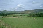
Looking back to Bodesbeck from Nowtrig Head geograph.org.uk 1260595

Bodesbeck Law is a hill in the Ettrick Hills range, part of the Southern Uplands of Scotland. It is the primary west-south-western terminus of the ridge that runs parallel to the A708 road along the Dumfries and Galloway-Scottish Borders border, occasionally titled the "Bodesbeck Ridge".

Excerpt from the Wikipedia article Bodesbeck Law (License: CC BY-SA 3.0, Authors, Images).

Geographical coordinates (GPS)

Latitude Longitude
N 55.3805 ° E -3.3116 °
placeShow on map

Address

Dumfries and Galloway


Scotland, United Kingdom
mapOpen on Google Maps

Looking back to Bodesbeck from Nowtrig Head geograph.org.uk 1260595
Share experience

Nearby Places

White Coomb
White Coomb

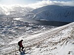
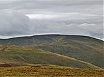
White Coomb is a hill in the Moffat Hills range, part of the Southern Uplands of Scotland. Its broad summit is the highest point in the range and the registration county of Dumfriesshire, as well as being the fourth highest point in southern Scotland, however, despite this, it is largely concealed by other hills on all sides except its east and south east, making this the only direction from which its full scale can be seen. White Coomb is most easily climbed from the National Trust for Scotland car park underneath the Grey Mare's Tail waterfall, on the A708 from Moffat to Selkirk, at NT 186146. The most direct route heads directly west up a steep ridge, but a more comfortable route follows a well built footpath above the north side of the waterfall. Above the waterfall, the fast flowing Tail Burn must be crossed to avoid a long detour; although there are plenty of natural stepping stones, spate or icy conditions may make their use dangerous. From across the stream, the best route through the peat and heather follows the course of a wall leading to the summit of Upper Tarnberry. From there, the east ridge, which is steep and craggy in places, leads to the broad summit. An alternative ascent, described by the Daily Telegraph as one of "Britain's finest half-day and day walks", follows the Tail Burn to the outlet of Loch Skeen before ascending the ridge to Mid Craig, and passing Donald's Cleuch Head to reach the summit. The descent suggested is via Rough Craig and south to join the road and walk back to the start point.

Grey Mare's Tail, Moffat Hills

Grey Mare's Tail is a 60-metre (200 ft) hanging valley waterfall near to Moffat in southern Scotland. The fall is produced by the Tail Burn flowing from Loch Skeen cascading into the Moffat Water in the lower valley below. The surrounding area forms the Grey Mare's Tail Nature Reserve, owned by the National Trust for Scotland. The footpath from the valley floor up to Loch Skeen is one of the more popular walks in the area. Parking is also provided. Grey Mare's Tail Nature Reserve is situated along the Moffat Water Valley in the heart of the Southern Uplands. This National Trust for Scotland property extends over 922 hectares and is characterised by a dramatic waterfall (the 5th highest in the UK), an upland loch Loch Skeen and White Coomb which rises to 821m and is one of the highest hills in Southern Scotland. The post-glacial landscape is an open mosaic of heather and rough grazing that includes 8 habitats of European importance and many plant species of international, national and regional significance. The reserve is botanically diverse, containing the richest assemblage of rare upland plants in Southern Scotland. Recognised as a Special Area of Conservation, Grey Mare's Tail Nature Reserve is popular with hill walkers, botanists and wildlife enthusiasts. There is also historical evidence of Iron Age settlers and the Covenanters who sought sanctuary here in the 17th century. Notable animal species: peregrine falcon, ring ouzel, raven, vendace and wild goats. Rare plants: many, including oblong woodsia, montane willows, and alpine saw-wort.

Dob's Linn
Dob's Linn

Dob's Linn is a small steep valley in Dumfries and Galloway, just north of the A708 road between Moffat and Selkirk, in Scotland. It is part of the Grey Mare's Tail Nature Reserve which is owned by the National Trust for Scotland. According to tradition, Dob's Linn is named for a covenanter, Halbert Dobson, who took refuge there from Government troops during The Killing Time in the late 17th century.Dob's Linn is important in geology as the location of the Global Boundary Stratotype Section and Point (GSSP) which marks the boundary between the Ordovician and Silurian periods, and marks the base of the Llandovery epoch, on the geologic time scale. Dob's Linn was ratified as the GSSP by the International Union of Geological Sciences in 1984.The boundary is defined as the first appearance of graptolites Parakidograptus acuminatus and Akidograptus ascensu 1.6 m above the base of the Birkhill Shale Formation. The shale section also contains chitinozoa and conodonts, but neither are well preserved. Dob's Linn has been criticized for the difficulty in relating its graptolite biostratigraphic sequence with shallow water sequences elsewhere, although the stratotype also appears to correspond with a carbon-13 isotope excursion in the latest Ordovician which can be identified worldwide.The area was first studied by Charles Lapworth in the late 19th century. His work established fossil graptolites as a method of understanding stratigraphic sequences. A more recent description of the area, enumerating the zones established by Lapworth, is given in the British Regional Geology Monograph. Before Lapworth's work, it was thought that the Silurian rocks of the Southern Uplands formed a single sequence, that would have to be about 6000m in thickness. By his identification of particular graptolite species in different zones of the Dob's Linn exposure, Lapworth was able to demonstrate that the Uplands consist of a much thinner layer, consistent with Silurian deposits elsewhere, that had been repeatedly folded and faulted, with multiple repetitions of the same strata, often upside down. The understanding that sequences of sedimentary rocks could be inverted played an important part in the later resolution of the Highlands Controversy in which Lapworth was also involved.