place

't Haantje, Drenthe

CoevordenPopulated places in Drenthe
't Haantje
't Haantje

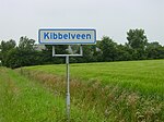
't Haantje (the Little Rooster) is a small village in the northeastern Netherlands. It is situated northwest of Emmen and is part of the municipality of Coevorden. It lies along the Oranjekanaal, between Noord-Sleen and Klijndijk. 't Haantje was first mentioned in 1874. The etymology is unclear. It was founded when peat labourers decided to settle there. On 1 December 1965, the village barely escaped a disaster. A French company working for the N.A.M. was drilling for gas, and started to lose control of the enormous gas pressure. During the afternoon, this resulted in a huge gas eruption. The ground around the hole caved in - swallowing all of the drilling equipment. The gas eruption was eventually stopped by a cement injection from a new drilling hole. A small lake lake surrounded by a forest forms a permanent reminder of this event.

Excerpt from the Wikipedia article 't Haantje, Drenthe (License: CC BY-SA 3.0, Authors, Images).

't Haantje, Drenthe
't Haantje,

Geographical coordinates (GPS) Address Nearby Places
placeShow on map

Wikipedia: 't Haantje, DrentheContinue reading on Wikipedia

Geographical coordinates (GPS)

Latitude Longitude
N 52.814722222222 ° E 6.8230555555556 °
placeShow on map

Address

't Haantje 53
7847 TB ('t Haantje)
Drenthe, Netherlands
mapOpen on Google Maps

't Haantje
't Haantje
Share experience

Nearby Places

Sleen
Sleen

Sleen is a village in Drenthe, Netherlands of about 2,500 people. Sleen has been inhabited for centuries. Much ancient history can be found in the area, particularly in the forests (which are planted, though). At birth and during the Republiek der Zeven Verenigde Nederlanden (Republic of the Seven United Netherlands (1581–1795)). Sleen became the capital of one of the six “dingspels” (administrative areas) of Drenthe. When Drenthe was recognised as a province, Sleen became a municipality capital, before it merged into the municipality of Coevorden. Sleen has a 450-year-old church. At about 68 meters, it is the highest church in the entire province. Nowadays, it functions as a Dutch Reformed Church. There is also another Protestant church in the village. Sleen has its own supermarket (behind the former police station), library, fish stand (every Wednesday), cafés, a few other shops, hair salons, petrol station, sports park (soccer, tennis, multipurpose indoor complex), horse riding school, houses for the elderly, and other facilities. There are also two schools: CBS “de Fontein” (Christian primary school) and OBS “de Akker” (public primary school). “De Brink” is the “centre” and the old part of the village, with some historic houses and a brick road. This is also where the two churches are, and other facilities like the former municipal centre. New houses were constructed over time, and an area known as “de nieuwbouw” is where the most recently constructed houses can be found. The famous Pieterpad (a 498 kilometres (309 mi) long hiking route that runs from Pieterburen in the north of the country to the St Pietersberg in Maastricht in the south) goes straight through Sleen. The windmill De Hoop has been restored to working order.