West Irvine, Irvine, California
Irvine, CaliforniaOrange County, CaliforniaOrange County, California geography stubsVillages of Irvine, California
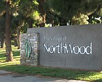
West Irvine is a neighborhood in Irvine, California. It is bounded by Jamboree Road to the northwest, California State Route 261 to the southeast, and Irvine Boulevard to the southwest. Despite its name, West Irvine is located in the northern reach of the city, bordering Tustin. The neighborhood was named for its location west of the Northwood and Northpark neighborhoods. West Irvine is adjacent to The Market Place, a major shopping center in the region. The West Irvine area contains 8,413 homes with an average home value of US$819,000. The average household size is 2.72 people and the median household income in 2019 was US$100,745.
Excerpt from the Wikipedia article West Irvine, Irvine, California (License: CC BY-SA 3.0, Authors).West Irvine, Irvine, California
Monument Place, Irvine Lower Peters Canyon
Geographical coordinates (GPS) Address Nearby Places Show on map
Geographical coordinates (GPS)
| Latitude | Longitude |
|---|---|
| N 33.7378 ° | E -117.774 ° |
Address
Monument Place 6
92602 Irvine, Lower Peters Canyon
California, United States
Open on Google Maps


