Residential red zone
2011 Christchurch earthquakeUse New Zealand English from January 2020

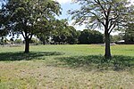
A residential red zone is any of several areas of land in and around Christchurch, New Zealand, that experienced severe damage in the 2010 and 2011 Christchurch earthquakes and were deemed infeasible to rebuild on. Through voluntary buyouts, the Crown acquired and demolished or removed over 8,000 properties.: 5 The majority were located in a broad swath of the eastern suburbs along the Avon River / Ōtākaro that had suffered damage from soil liquefaction.
Excerpt from the Wikipedia article Residential red zone (License: CC BY-SA 3.0, Authors, Images).Residential red zone
New Brighton Road, Christchurch Burwood (Coastal-Burwood Community)
Geographical coordinates (GPS) Address Nearby Places Show on map
 Continue reading on Wikipedia
 Geographical coordinates (GPS)
| Latitude | Longitude |
|---|---|
| N -43.505833333333 ° | E 172.67972222222 ° |
Address
New Brighton Road 158A
8640 Christchurch, Burwood (Coastal-Burwood Community)
Canterbury, New Zealand
Open on Google Maps