place

Rachka

Rivers of MoscowTributaries of the Moskva

The Rachka (Russian: Рачка) is a small river located in the Basmanny and Tagansky Districts, in the Central Administrative Okrug, in the center of Moscow and a former left tributary of the Moskva. Today it flows into the Yauza.

Excerpt from the Wikipedia article Rachka (License: CC BY-SA 3.0, Authors).

Rachka
Устьинская набережная, Moscow Tagansky District

Geographical coordinates (GPS) Address Nearby Places
placeShow on map

Wikipedia: RachkaContinue reading on Wikipedia

Geographical coordinates (GPS)

Latitude Longitude
N 55.748888888889 ° E 37.644444444444 °
placeShow on map

Address

Яузские Ворота

Устьинская набережная
109240 Moscow, Tagansky District
Moscow, Russia
mapOpen on Google Maps

Share experience

Nearby Places

Kotelnicheskaya Embankment Building

Kotelnicheskaya Embankment Building is one of seven Stalinist skyscrapers laid down in September 1947 and completed in 1952, designed by Dmitry Chechulin (then Chief Architect of Moscow) and Andrei Rostkovsky. The main tower has 32 levels (including mechanical floors) and is 176 metres (577 ft) tall. At the time of construction it was the tallest building in Europe.The building also incorporates a 9-story apartment block facing Moskva River, designed by the same architects in 1938 and completed in 1940. Initially built in stern early Stalinist style, with wet stucco wall finishes, it was re-finished in terracotta panels in line with the central tower and acquired ornate pseudo-Gothic crowns over its 12-story raised corners and center tower. By the end of World War II, the side wing was converted to multi-family kommunalka housing, in contrast to the planned elite status of the central tower. The central tower, of a conventional steel frame structural type, has a hexagonal cross-section with three side wings (18 stories, including two mechanical floors). While it is not exceptionally tall or massive, the "upward surge" of five stepped-up layers, from a flat 9-story side wing to the spire, gives the impression of a more massive structure. The structure hides behind itself a so-called "Shvivaya Gorka," a hill with historical architecture and a maze of steeply inclined streets. Chechulin was initially criticized for complete disregard of this area, but his bureaucratic influence brushed off any criticisms.

Yauza (river)
Yauza (river)

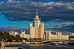
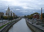
The Yauza (Russian: Я́уза) is a river in Moscow and Mytishchi, Russia, a tributary of the Moskva. It originates in the Losiny Ostrov National Park northeast of Moscow, flows through Mytishchi, enters Moscow in the Medvedkovo District and flows through the city in an irregular, meandering, generally north-south direction. The Yauza joins the Moskva River in Tagansky District just west of Tagansky Hill, now marked by the Kotelnicheskaya Embankment tower. Valleys of the Yauza, from the MKAD beltway in the north to the Moscow-Yaroslavl railway west of Sokolniki Park, are protected as natural reserves.The Yauza has been mentioned in Russian chronicles since 1156; the exact origin of the name is unknown. Moscow crossed its former natural eastern boundary (marked by the Yauza) in the beginning of the 16th century. The banks of the Yauza within the Garden Ring were densely urbanized by the middle of the 17th century; upstream valleys housed suburban residences of the House of Romanov, from Mikhail to Catherine II. Settlements along the Yauza (German Quarter, Lefortovo, Preobrazhenskoye) played a significant role in the history of Russia in the 17th and 18th centuries. Industrialization in the 19th and 20th centuries made the Yauza "the biggest gutter for waste in Moscow". In the 2000s the ecology improved, with the closing or conversion of old factories and cleanup efforts by the city government. In 2007 the Yauza waters were reclassified from "dirty" to "polluted" status, but in 2008 the trend reversed and pollution in the Yauza exceeded its 2006 levels. As of 2008, Yauza water passing the Moscow city boundary is rated as "polluted", and reaches a "very dirty" level at its inlet. Untreated surface runoff in the Central Administrative District remains the main source of pollution.