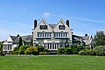
Bardsey, West Yorkshire
City of LeedsOpenDomesdayUse British English from March 2015Villages in West YorkshireWest Yorkshire geography stubs

Bardsey, West Yorkshire, England is a small village in the City of Leeds metropolitan borough, 8 miles (13 km) north east of Leeds city centre. The village is in the LS17 Leeds postcode district. It is part of the civil parish of Bardsey cum Rigton. The village itself lies just off the A58 road between Leeds and Wetherby. It is a predominantly middle class area with a high proportion of retired residents. Housing is mixed; while most is private, there is council housing situated near Keswick Lane. Facilities include a public house and sports club (with a cricket pitch and two football pitches). Bardsey also has a primary school and an Anglican church.
Excerpt from the Wikipedia article Bardsey, West Yorkshire (License: CC BY-SA 3.0, Authors, Images).Bardsey, West Yorkshire
Woodacre Lane, Leeds Bardsey cum Rigton
Geographical coordinates (GPS) Address Nearby Places Show on map
Geographical coordinates (GPS)
| Latitude | Longitude |
|---|---|
| N 53.884 ° | E -1.445 ° |
Address
Woodacre Lane
Woodacre Lane
LS17 9DF Leeds, Bardsey cum Rigton
England, United Kingdom
Open on Google Maps


