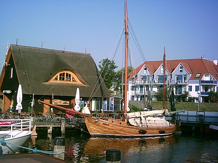
Zingst

Zingst (German pronunciation: [ˈt͡sɪŋst]; Polabian Sgoni) is the easternmost portion of the three-part Fischland-Darß-Zingst Peninsula, located in Mecklenburg-Vorpommern, Germany, between the cities of Rostock and Stralsund on the southern shore of the Baltic Sea. The area is part of the Pomeranian coast. The Zingst Peninsula forms an eastward-running spit, nearly 20 km (12 mi) in length, and has a width of just 2 to 4 km (1.2 to 2.5 mi). Zingst separates the Baltic Sea from the lagoon of Barther Bodden, which is part of the Darss-Zingst Bodden Chain, a large estuary. The shallow waters of the inlet are a major stopover for the migratory European crane. In spring and autumn, up to 3,000 birds gather here on their migration route to and from Spain. Most of the estuary and the eastern end of the peninsula are part of the Western Pomerania Lagoon Area National Park. Until the early 1870s, Zingst was an island, separated from Darß by the Prerowstrom, a narrow inlet. A storm tide in 1874 closed the inlet, which had connected the bodden with the Baltic Sea. A road now connects Zingst and Darß, running along a 100 m (330 ft)-wide isthmus. The soils of Zingst consist almost entirely of sand. The sand is white in colour, which makes it popular with sunbathers and tourists. Dunes border the Baltic Sea and enclose low ground about half a metre below sea level. The low-lying land results in boggy conditions in the interior of the peninsula, and these bogs offer habitat to a wide variety of wildlife. The ruins of a Slavic fort, the 'Hertesburg,' are on the Zingst peninsula near Zingst municipality.
Excerpt from the Wikipedia article Zingst (License: CC BY-SA 3.0, Authors, Images).Zingst
L 21,
Geographical coordinates (GPS) Address Nearby Places Show on map
Geographical coordinates (GPS)
| Latitude | Longitude |
|---|---|
| N 54.416666666667 ° | E 12.666666666667 ° |
Address
L 21
18374
Mecklenburg-Vorpommern, Germany
Open on Google Maps


