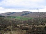
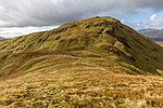
Beinn Chaorach (Graham)
Argyll and Bute geography stubsGrahamsMarilyns of ScotlandMountains and hills of Argyll and Bute

Beinn Chaorach (713 m) is a hill in the southern foothills of the Grampian Mountains of Scotland. It lies in the Luss Hills of Argyll and Bute, between Loch Lomond and Loch Long. The most southerly of the Luss Hills, this grassy peak is often climbed in conjunction with its neighbour Beinn a' Mhanaich, although Ministry of Defence land lies to the west of the summit, so this side should be avoided.
Excerpt from the Wikipedia article Beinn Chaorach (Graham) (License: CC BY-SA 3.0, Authors, Images).Beinn Chaorach (Graham)
Path to Beinn Chaorach,
Geographical coordinates (GPS) Address Nearby Places Show on map
Geographical coordinates (GPS)
| Latitude | Longitude |
|---|---|
| N 56.09333 ° | E -4.75443 ° |
Address
Path to Beinn Chaorach
Path to Beinn Chaorach
G84 8YT
Scotland, United Kingdom
Open on Google Maps


