place

Happy Camp Canyon Regional Park

Moorpark, CaliforniaParks in Ventura County, California
Happy Camp Canyon Regional Park

Happy Camp Canyon Regional Park is a 3,000-acre (1,200 ha) regional park located in the eastern foothills of Moorpark, California. The park has been run by the Mountains Recreation and Conservation Authority since 1990.

Excerpt from the Wikipedia article Happy Camp Canyon Regional Park (License: CC BY-SA 3.0, Authors, Images).

Happy Camp Canyon Regional Park
Saviers Road,

Geographical coordinates (GPS) Address Website Nearby Places
placeShow on map

Wikipedia: Happy Camp Canyon Regional ParkContinue reading on Wikipedia

Geographical coordinates (GPS)

Latitude Longitude
N 34.339 ° E -118.86 °
placeShow on map

Address

Happy Camp Canyon Regional Park

Saviers Road

California, United States
mapOpen on Google Maps

Website
mrca.ca.gov

linkVisit website

Happy Camp Canyon Regional Park
Share experience

Nearby Places

Moorpark station
Moorpark station

Moorpark station is a passenger rail station in the city of Moorpark, California. Service commenced in 1983 as an infill station on the short-lived CalTrain line. The station was rebuilt in 1992 to accommodate the new Metrolink Ventura County Line commuter trains. Service on that line began on October 26, 1992; Amtrak's Santa Barbara–San Diego San Diegan trains had begun stopping there the day before.Amtrak's Pacific Surfliner from San Luis Obispo to San Diego and Metrolink's Ventura County Line from Los Angeles Union Station to East Ventura stop here. Moorpark station is served by ten Amtrak Pacific Surfliner trains (five in each direction) every day, with departures evenly spaced throughout the day. Sixteen Metrolink Ventura County Line trains (eight in each direction) serve the station each weekday, running during peak hours in the peak direction of travel. On weekends, four Metrolink Ventura County Line trains (two in each direction) serve the station. Metrolink passengers also have access to all Pacific Surfliner trains through a codesharing arrangement with Amtrak.Moorpark served as the Ventura County Line's terminal until service was extended to Oxnard after the Northridge earthquake in 1994, and now acts as the western terminus of the Ventura County Line except during peak hours in the peak direction of travel. Metrolink stores trains in a small yard a short distance west of the station.In FY2018, boarding or detraining Amtrak passengers averaged approximately 50 passengers daily.

Oak Park, Simi Valley

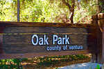
Oak Park is a 100.5-acre open space regional park (40.7 ha) located at 901 Quisma Drive in Simi Valley, California, near Moorpark and California State Route 118. This county park, maintained by the Santa Monica Mountains Conservancy, is situated in the foothill country surrounded by rolling hills in the extreme west Simi Valley. Oak Park is recognized for its many large oak trees, rolling hills, canyons, wildlife, and hiking trails through abundance of coastal scrub brush. The facilities offered are a playground, horseshoe pits, basketball court, picnic tables, restroom, dump station for RV’s, water fountain, BBQ, fire rings, as well as tent- and RV-camping. Oak Park is a reservation only park with a 2 night minimum. There are partial hookups and 30 amp service at 16 campsites in 2018 for tents or RV’s, a 16 space rv group camping area and one group tent site area for up to fifty people. There are 4-day use group areas. There are occasionally summer programs in the camping site area. The park is home to various native flora and also wildlife, which consists of a wide range of Simi Valley native species such as numerous raptors, sagebrush lizards, alligator lizards, roadrunners, hummingbirds, grey foxes, bobcats, raccoons, opossums, skunks, and various snakes, including the Southern Pacific Rattlesnake and California Kingsnake. The park district is in the process of acquiring the 734-acre Alamos Canyon (297 ha) on the other side of West Los Angeles Avenue. A trail connecting Oak Park to the Alamos Canyon would be created and included within a greenbelt between the cities of Simi Valley and Moorpark.

Bardsdale, California

Bardsdale is a rural unincorporated community and populated place in Ventura County, California. It is located in the orange blossom and agricultural belt of the Santa Clara River Valley, south of the Santa Clara River and on the north slope of South Mountain. The closest town is Fillmore, which is on the north side of the Santa Clara about 3 miles (5 km) from Bardsdale. Santa Paula is about 7 miles (11 km) west, the most direct route being South Mountain Road. Moorpark is about 6 miles (10 km) south over the serpentine mountain road known as Grimes Canyon. The Bardsdale area has long been a center of citrus ranching, having a large number of verdant orange orchards with home sites interspersed among them. The citrus of Sunkist growers in Bardsdale is sold throughout the country and around the world. Oranges - mostly Valencias - are the main crop, other crops include lemons, avocados, and row cropped vegetables. Bardsdale gently slopes from South Mountain to the river and has a sweeping, panoramic view of the Santa Clara River Valley, dominated by the peaks of the Sespe and San Cayetano Mountains. The community is home to the Bardsdale United Methodist Church, which is listed on the National Register of Historic Places. The Bardsdale Cemetery serves the community as well as Fillmore, which has no other cemetery. The Elkins Ranch Golf Course is on the east edge of Bardsdale. The area is serviced by the Ventura County Sheriff's Department and the Ventura County Fire Department.