Bratton Downs
Bratton, WiltshireEngvarB from August 2019Hills of WiltshireSites of Special Scientific Interest in WiltshireSites of Special Scientific Interest notified in 1971

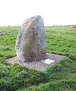
Bratton Downs (grid reference ST925522) is a 395.8 hectare biological and geological Site of Special Scientific Interest in Wiltshire, England, near the villages of Bratton and Edington, and about 3 miles (5 km) east of the town of Westbury. It was notified in 1971. The designated area consists mainly of chalk grassland, as well as some ancient woodland, and supports a diverse range of native flora and fauna. It overlays notable geological features—principally landforms created by glaciation in the Pleistocene.
Excerpt from the Wikipedia article Bratton Downs (License: CC BY-SA 3.0, Authors, Images).Bratton Downs
Watercress Walk,
Geographical coordinates (GPS) Address Nearby Places Show on map
Geographical coordinates (GPS)
| Latitude | Longitude |
|---|---|
| N 51.2689 ° | E -2.1089 ° |
Address
Watercress Walk
BA13 4SH , Edington
England, United Kingdom
Open on Google Maps


