San Jacinto Peak

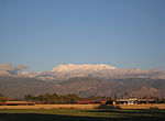
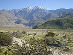
San Jacinto Peak ( SAN hə-SIN-toh, - jə-, - yə-; often designated Mount San Jacinto) is a 10,834 ft (3,302 m) peak in the San Jacinto Mountains, in Riverside County, California. Lying within Mount San Jacinto State Park it is the highest both in the range and the county, and serves as the southern border of the San Gorgonio Pass. Naturalist John Muir wrote of San Jacinto Peak, "The view from San Jacinto is the most sublime spectacle to be found anywhere on this earth!"San Jacinto Peak is one of the most topographically prominent peaks in the United States, and is ranked the sixth most prominent peak in the 48 contiguous states. According to John W. Robinson and Bruce D. Risher, authors of The San Jacintos, "No Southern California hiker worth his salt would miss climbing 'San Jack' at least once."Known for its spectacular north escarpment, the peak rises over 8,000 feet (2,400 m) above San Gorgonio Pass. It plays host to the famous Cactus to Clouds Trail.
Excerpt from the Wikipedia article San Jacinto Peak (License: CC BY-SA 3.0, Authors, Images).San Jacinto Peak
Peak Trail,
Geographical coordinates (GPS) Address Nearby Places Show on map
Geographical coordinates (GPS)
| Latitude | Longitude |
|---|---|
| N 33.814712342 ° | E -116.679438022 ° |
Address
Peak Trail
Peak Trail
California, United States
Open on Google Maps


