Sullivan Bay, Victoria

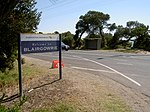
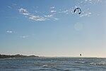
Sullivan Bay lies 60 km (37 mi) due south of Melbourne on Port Phillip, one kilometre (0.6 mi) east of Sorrento, Victoria. It was established as a short-lived convict settlement in 1803 by Lieutenant-Colonel David Collins, who named the bay after the Under-Secretary of State for War and the Colonies, John Sullivan. The site was chosen because of its strategic location near the entrance of Port Phillip Bay. The settlement is significant because it was the first attempt to settle Europeans permanently in what is now Victoria and was a key link in the expansion of the colony of New South Wales into Tasmania and Victoria, and the control of Bass Strait as a trade route.
Excerpt from the Wikipedia article Sullivan Bay, Victoria (License: CC BY-SA 3.0, Authors, Images).Sullivan Bay, Victoria
Point Nepean Road, Melbourne Sorrento
Geographical coordinates (GPS) Address Nearby Places Show on map
Geographical coordinates (GPS)
| Latitude | Longitude |
|---|---|
| N -38.347777777778 ° | E 144.76055555556 ° |
Address
Point Nepean Road
3943 Melbourne, Sorrento
Victoria, Australia
Open on Google Maps


