place

Ladera, Los Angeles

Neighborhoods in Los Angeles
Ladera neighborhood of Los Angeles city

Ladera is a neighborhood in Los Angeles, California, lying between Inglewood and an unincorporated area of Los Angeles County.The first homes built in the Ladera Heights home development in 1946 were built in the City of Los Angeles section on Condin Avenue ... As the home development spread to the west of La Cienega in the 1950s and 1960s, the original area became known as "Old Ladera."In 2011 the Los Angeles City section was made a part of the 11th Councilmanic District, and residents petitioned later that this neighborhood be officially recognized under the name of Ladera. The naming as a Los Angeles neighborhood was done by the Los Angeles City Council on February 24, 2017, and neighborhood signs were placed by the city beginning in July of that year.

Excerpt from the Wikipedia article Ladera, Los Angeles (License: CC BY-SA 3.0, Authors, Images).

Ladera, Los Angeles
Shenandoah Avenue,

Geographical coordinates (GPS) Address Nearby Places
placeShow on map

Wikipedia: Ladera, Los AngelesContinue reading on Wikipedia

Geographical coordinates (GPS)

Latitude Longitude
N 33.998 ° E -118.373 °
placeShow on map

Address

Shenandoah Avenue 4913
90056 , Ladera Heights
California, United States
mapOpen on Google Maps

Ladera neighborhood of Los Angeles city
Share experience

Nearby Places

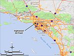
Inglewood Oil Field
Inglewood Oil Field

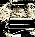
The Inglewood Oil Field in Los Angeles County, California, is the 18th-largest oil field in the state and the second-most productive in the Los Angeles Basin. Discovered in 1924 and in continuous production ever since, in 2012 it produced approximately 2.8 million barrels of oil from some five hundred wells. Since 1924 it has produced almost 400 million barrels, and the California Department of Oil, Gas and Geothermal Resources (DOGGR) has estimated that there are about 30 million barrels remaining in the field's one thousand acres, recoverable with present technology.The field is operated by Sentinel Peak Resources, which acquired it in their purchase of Freeport McMoRan's onshore California oil and gas assets in 2016. Freeport McMoRan acquired it from Plains Exploration & Production in 2013. Surrounded by Los Angeles and its suburbs, and having over one million people living within five miles of its boundary, it is the largest urban oil field in the United States. Freeport had pursued a vigorous program of field development through water-flooding and well stimulation to increase production, which has been slowly declining since the field's peak in 1925. In recent years, field expansion and revitalization have been controversial with adjacent communities, which include Culver City, Baldwin Hills, and Ladera Heights. Several organizations have formed to oppose field development, in particular the proposed use of hydraulic fracturing as a well stimulation technique. In response, to assuage the fears of the surrounding community, Freeport McMoran's consultants have published reports attempting to show that such practices are safe. Additionally, in 2008 the Los Angeles County Board of Supervisors adopted a Community Standards District (CSD) for Baldwin Hills, specifically to regulate development and operations in the oil field to make it compliant with community environmental standards. On September 15, 2021 the Los Angeles County Board of Supervisors voted 5-0 to close the Inglewood Oil Field.

Baldwin Hills Dam disaster

The Baldwin Hills Dam disaster occurred on December 14, 1963 (1963-12-14) in the Baldwin Hills neighborhood of South Los Angeles, when the dam containing the Baldwin Hills Reservoir suffered a catastrophic failure and flooded the residential neighborhoods surrounding it. It began with signs of lining failure, followed by increasingly serious leakage through the dam at its east abutment. After three hours, the dam breached, and "it took only 77 minutes for all the water to pour out into Cloverdale Avenue, La Brea Avenue, La Cienega and Jefferson Boulevard." The collapse resulted in a release of 290 million US gallons (1,100,000 m3), causing five deaths and the destruction of 277 homes. Damage totaled $12 million and the disaster caused a water shortage for 500,000 people. Some 16,000 people lived in the flooded area. Vigorous rescue efforts averted a greater loss of life.The reservoir was constructed on a low hilltop between 1947 (1947) and 1951 (1951) by the Los Angeles Department of Water and Power, directly on an active fault line, which was subsidiary to the well-known nearby Newport–Inglewood Fault. The underlying geologic strata were considered unstable for a reservoir, and the design called for a compacted soil lining meant to prevent seepage into the foundation. The fault lines were considered during planning, but were deemed by some, although not all, of the engineers and geologists involved as not significant.The former reservoir is now part of the Kenneth Hahn State Recreation Area. A plaque was placed at the site on the 50th anniversary of the disaster in 2013.

Stoneview Nature Center

Stoneview Nature Center is a county-operated garden and educational facility in Culver City, California along the Park to Playa Trail.The nature center building and gardens are part of a “transformation of a five-acre brownfield site in the Baldwin Hills neighborhood of Culver City, California.” The main building, designed by Ehrlich Yanai Rhee Chaney Architects, is 4,000 square feet (370 m2) and features community space, a meeting/classroom, an outdoor kitchen, and bathrooms.The park, which has a focus on native California and edible plantings, includes a raised-bed Mediterranean demonstration garden, a native grass meadow, and installations by the contemporary art collective Fallen Fruit. The edible landscaping includes oranges, avocados, figs, grapes, lemons, blackberries, and blueberries, and less-familiar California native edibles including lemonade berry, coffee berry and prickly pear. Fitness equipment and workout classes are offered at the park. Stoneview is a key segment of the 13 mi (21 km) Park to Playa Trail; “good views of L.A. are guaranteed on the dirt-and-paved track from Baldwin Hills to Playa del Rey.”The center operates an apiary in partnership with HoneyLove as well as a furnishing an elaborate hotel for native bee, both as part of a public outreach campaign on the importance of pollinating insects. Stoneview was recommended by local public-radio station KCRW as an outdoor refuge during the pandemic.The land was previously a primary school campus from 1956 to 2010, and was acquired by the Baldwin Hills Regional Conservation Authority in 2011.