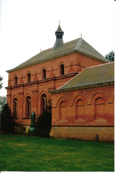
Papplewick Pumping Station

Papplewick Pumping Station, situated in open agricultural land approximately 3 miles (4.8 km) by road from the Nottinghamshire village of Papplewick, was built by Nottingham Corporation Water Department between 1881 and 1884 to pump water from the Bunter sandstone to provide drinking water to the City of Nottingham, in England. Two beam engines, supplied with steam by six Lancashire boilers, were housed in Gothic Revival buildings. Apart from changes to the boiler grates, the equipment remained in its original form until the station was decommissioned in 1969, when it was replaced by four submersible electric pumps. A Trust was formed in 1974 to conserve the site as a static museum, but the plans soon developed to include the refurbishment and regular steaming of the engines. One of the beam engines was operated in 1975, using the only boiler that was certified to be safe at the time. Since then, the second engine has been reconditioned, and both are steamed several times a year. New visitor facilities were built in 1991, and a major restoration of the structures was completed in 2005, following a grant of £1.6 million by the Heritage Lottery Fund. As well as the beam engines, the site houses several other engines, which are also demonstrated on steaming days.
Excerpt from the Wikipedia article Papplewick Pumping Station (License: CC BY-SA 3.0, Authors, Images).Papplewick Pumping Station
Rigg Lane, Gedling
Geographical coordinates (GPS) Address Website External links Nearby Places Show on map
Geographical coordinates (GPS)
| Latitude | Longitude |
|---|---|
| N 53.0636 ° | E -1.1304 ° |
Address
Papplewick Pumping Station
Rigg Lane
NG15 9AJ Gedling
England, United Kingdom
Open on Google Maps


