Pakenham, Victoria
Pages including recorded pronunciationsSuburbs of MelbourneSuburbs of the Shire of CardiniaTowns in Victoria (state)Use Australian English from August 2019 ... and 1 more
Vague or ambiguous time from November 2019

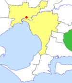
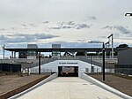
Pakenham ( PAK-ə-nəm) is a suburb of Melbourne in Victoria, Australia, 53 km (33 mi) south-east of Melbourne's Central Business District and the most populous in the Shire of Cardinia. Pakenham recorded a population of 54,118 at the 2021 census. Pakenham has become a major growth area in south-eastern Melbourne as new housing developments have boosted its population and infrastructure, as exemplified in the development of the Lakeside, Heritage Springs and Cardinia Lakes estates.
Excerpt from the Wikipedia article Pakenham, Victoria (License: CC BY-SA 3.0, Authors, Images).Pakenham, Victoria
Atkins Road, Melbourne Pakenham
Geographical coordinates (GPS) Address Nearby Places Show on map
Geographical coordinates (GPS)
| Latitude | Longitude |
|---|---|
| N -38.0712 ° | E 145.4878 ° |
Address
Atkins Road
Atkins Road
3810 Melbourne, Pakenham
Victoria, Australia
Open on Google Maps


