place

Chelae (Bosphorus)

Ancient Bithynia geography stubsFormer populated places in TurkeyHistory of Istanbul ProvinceIstanbul Province geography stubsPopulated places in Bithynia

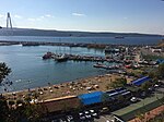
Chelae or Chelai (Ancient Greek: Χῆλαι) was a coastal town of ancient Bithynia located on the Bosphorus. Its site is located near Keçili Liman in Asiatic Turkey.

Excerpt from the Wikipedia article Chelae (Bosphorus) (License: CC BY-SA 3.0, Authors).

Chelae (Bosphorus)
Orman Yolu,

Geographical coordinates (GPS) Address Nearby Places
placeShow on map

Wikipedia: Chelae (Bosphorus)Continue reading on Wikipedia

Geographical coordinates (GPS)

Latitude Longitude
N 41.187015 ° E 29.119739 °
placeShow on map

Address

Orman Yolu
34829
Turkey
mapOpen on Google Maps

Share experience

Nearby Places

Anadolukavağı
Anadolukavağı

Anadolukavağı (sometimes written as Anadolu Kavağı) is a neighbourhood in the municipality and district of Beykoz, Istanbul Province, Turkey. Its population is 1,517 (2022). It is at the northern end of the Bosphorus. "Anadolu" is the Turkish name for Anatolia, and "kavak" meant "control post" in Ottoman Turkish, suggesting the strategic importance of its location. It is directly across from Rumeli Kavağı, the Greek or European control post on the other side of the Bosphorus. Anadolu Kavağı was originally called Hieron (Ancient Greek: ἱερόν) and was an important outpost for the Romans and the Byzantines.It has been suggested that n the past some villagers acted as 'wreckers', lighting fires to disorient ships and ground them in the narrow Strait so that they could seize their cargo. Others claim that Anadolu Kavağı served as a refuge where trade ships could shelter from storms. Once a fishing village, it retains a village atmosphere and has many fish restaurants offering lunches for passengers on the longer Bosphorus cruises which usually terminate here. Although there are few permanent residents, the military personnel at surrounding bases contribute to a total population of about 1,500. The village's most prominent historic structures are a small mosque commissioned by Ali Pasha of Midilli (Lesbos) in 1593, and a fountain commissioned by Cevriye Hatun in 1785. Ruinous Yoros Castle, an old Genoese fortress, stands on the hill above Anadolu Kavağı. From its walls there are fine views out towards the Third Bosphorus Bridge and the Black Sea.Şehir Hatları, the city ferry company, offers sailings to and from Üsküdar and points in between. The twice-daily long Bosphorus ferry services leave Eminönü for Anadolu Kavağı, calling in at points en route including Sarıyer and Rumeli Kavağı on the European shore of the Bosphorus. The village is also served by an hourly bus service from Üsküdar.

Akbaba, Istanbul

Akbaba is a neighbourhood in the municipality and district of Beykoz, Istanbul Province, Turkey. Its population is 2,771 (2022). It is home to the türbe of Akbaba Sultan (Akbaba Mehmed Efendi or Akmehmet Efendi in short), a Bektashi Sufi baba who participated in the Conquest of Constantinople and was a mentor of Ottoman Sultan Mehmet the Conqueror (reigned 1444–1446, 1451–1481). Following the Conquest, he moved to this valley rich with spring waters and established a tekke with his dervish murids. The tekke was last revived by the Naqshbandi Shaykh Abdulhakim Efendi of Bukhara between 1876 and 1889.Canfeda Hatun, a noblewoman attendant of Sultan Murad III’s mother, completed building a mosque in 1588 which bears her name.It is thought that the Sufi complex first fell into disuse, along with all other Bektashi lodges in and around Istanbul, with its closure following the Auspicious Incident of 1826. Its followers were exiled from the area. Following an inactive period of half a century, during the reign of Sultan Abdulhamid II, it was turned over to Shaykh Abdulhakim by Abdulkadir Pasha, the commander of Istanbul central command. The pasha helped rebuild the center. Upon Shaykh Abdulhakim's passing in 1889, he was buried near Akbaba Sultan behind the tekke, which came to be Akbaba Cemetery extending up the hillside. His son Ahmed Mansur Mukerrem Efendi took his place and was active until the declaration of all tekkes and zawiyas to be illegal in 1925. The law for the closure of traditional institutions was passed on 30 November 1925 as part of Mustafa Kemal's reforms and revolutions.Religious institutions started to appear in public life along with the multi-party system following the 1950 Turkish general election. By this time, most of the tekke buildings were destroyed and only the mosque and attached harem section remained. The harem section was turned into an imam's office. The government of President Erdogan and his AK Party supported religious institutions and restored the mosque in the 2000s. The mosque was rebuilt again in the 2010s, keeping true to its original wooden form on a stone foundation, and reclaiming the entire borders of the complex with landscaping and a stone border wall.A Rifai tekke also existed in the village but its one known building fell into disuse, rotted away and was demolished for safety reasons. The graveyard of the tekke is preserved and lies next to the property of Akbaba Dergah. The successor of Shaykh Nazim al-Haqqani of Cyprus, Shaykh Mehmet Adil, resides here and his Dergah is also here. The area is famous for its greenery which attracts the filming of Turkish TV series.