place

Big Basin Redwoods State Park

1902 establishments in CaliforniaCampgrounds in CaliforniaCivilian Conservation Corps in CaliforniaCoast redwood grovesIUCN Category V
Old-growth forestsParks in Santa Cruz County, CaliforniaParks in the San Francisco Bay AreaProtected areas established in 1902Santa Cruz MountainsState parks of CaliforniaUse mdy dates from August 2023
Coast Redwood Stand in Big Basin State Park

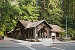
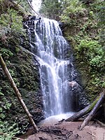
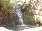
Big Basin Redwoods State Park is a state park in the U.S. state of California, located in Santa Cruz County, about 36 km (22 mi) northwest of Santa Cruz. The park contains almost all of the Waddell Creek watershed, which was formed by the seismic uplift of its rim, and the erosion of its center by the many streams in its bowl-shaped depression. Big Basin is California's oldest State Park, established in 1902, earning its designation as a California Historical Landmark. Its original 3,800 acres (15 km2) have been increased over the years to over 18,000 acres (73 km2). It is part of the Northern California coastal forests ecoregion and is home to the largest continuous stand of ancient coast redwoods south of San Francisco. It contains 10,800 acres (44 km2) of old-growth forest as well as recovering redwood forest, with mixed conifer, oaks, chaparral and riparian habitats. Elevations in the park vary from sea level to over 600 m (2,000 ft). The climate ranges from foggy and damp near the ocean to sunny, warm ridge tops. The park has over 130 km (81 mi) of trails. Some of these trails link Big Basin to Castle Rock State Park and the eastern reaches of the Santa Cruz range. The Skyline-to-the-Sea Trail threads its way through the park along Waddell Creek to Waddell Beach, and the adjacent Theodore J. Hoover Natural Preserve, a freshwater marsh.The park has many waterfalls, a wide variety of environments (from lush canyon bottoms to sparse chaparral-covered slopes), many species of mammals (deer, raccoons, an occasional bobcat) and abundant bird life – including Steller's jays, egrets, herons and acorn woodpeckers. The CZU Lightning Complex fires in August 2020 burned over 97% of Big Basin and destroyed the park headquarters, closing the park for 2 years during rebuilding efforts before it reopened in Summer 2022.

Excerpt from the Wikipedia article Big Basin Redwoods State Park (License: CC BY-SA 3.0, Authors, Images).

Big Basin Redwoods State Park
Chaussée de Tervueren - Tervuursesteenweg,

Geographical coordinates (GPS) Address Nearby Places
placeShow on map

Wikipedia: Big Basin Redwoods State ParkContinue reading on Wikipedia

Geographical coordinates (GPS)

Latitude Longitude
N 37.1725 ° E -122.2225 °
placeShow on map

Address

Église Sainte-Anne - Sint-Annakerk

Chaussée de Tervueren - Tervuursesteenweg 91
1160
Belgien
mapOpen on Google Maps

Coast Redwood Stand in Big Basin State Park
Share experience

Nearby Places

Skyline-to-the-Sea Trail

The Skyline-to-the-Sea Trail is a 29.5-mile (47.2-kilometre) hiking trail that descends from the ridge of the Santa Cruz Mountains in California to the Pacific Ocean, passing through Castle Rock State Park and Big Basin Redwoods State Park. Big Basin is California's oldest state park. It contains beautiful waterfalls and some of the largest, tallest, and oldest Redwood forests left in existence. After the August 2020 CZU Lightning Complex fires, the trail closed, along with much of Big Basin Redwoods State Park. As of December 2021, the trail remains closed and its future is unclear.The trail usually takes two to three days to complete, with nearly all thru-hikers traveling from East to West (towards the ocean). It is possible to walk the entire trail in one day, though this is unusual and very difficult. However, there is a 50-km (31-mi) ultra running race held on this trail one or two times per year. Many hikers like to take a detour up Berry Creek Trail to see the waterfalls or to camp at Sunset Trail Camp, adding 2.7 mi (4.3 km) to the hike. The trail begins at Saratoga Gap on the ridge at the intersection of SR 9 and Skyline Boulevard (SR 35), although many hikers actually begin at Castle Rock due to its overnight parking facility. The trail parallels SR 9 through Castle Rock, crosses the highway, and then follows SR 236 to Big Basin park headquarters. It then descends through Big Basin, following Waddell Creek to its outlet at Waddell Beach. Santa Cruz Metro routes 35 and 40 formerly went from Big Basin State Park Headquarters to Waddell Creek and back. Since September 2011, Route 40 no longer goes all the way to Waddell Beach from mid-December to mid-March. but instead turns around at Cement Plant Rd. Route 35 formerly stopped at Big Basin Headquarters on the weekends during the Spring/Summer season. As of October 2020, there is 3.6 mile (5.8 km) extension that creates a "Saratoga-to-the-Sea" Trail. The trail originates at Saratoga Quarry Park, and terminates at Sanborn-Skyline County Park. This trail connects to the Skyline-to-the-Sea Trail via a completed section of the Bay Area Ridge Trail. The park is owned by the city of Saratoga's Parks Department.

CZU Lightning Complex fires

The CZU Lightning Complex fires were wildfires that burned in Northern California starting in August 2020. The fire complex consisted of fires in San Mateo and Santa Cruz counties, including fires that had previously been separately tracked as the Warnella and Waddell fires. The firefighting effort was primarily administered by the California Department of Forestry and Fire Protection (Cal Fire).The first fires started around 3:30 A.M. on August 16, 2020, the result of a thunderstorm that produced close to 11,000 bolts of lightning and started hundreds of fires throughout California. These lightning strikes initially started fires separately known as the Warnella Fire, near Davenport and the Waddell Fire, near Waddell Creek, as well as three fires on what would become the northern edge of the CZU Complex fire. Two days after the fires began, a change in wind conditions caused these three northern fires to rapidly expand and merge, growing quickly to over 40,000 acres.The fires destroyed 1,490 buildings, including in the communities of Boulder Creek, Bonny Doon, Swanton, and along Empire Grade Road. Fires burned in both Butano and Big Basin Redwoods state parks, where a number of historic buildings were destroyed, including the visitor's center at Big Basin.On September 22, Cal Fire reported that the complex, which had covered 86,509 acres (35,009 ha), had been fully contained On December 23 Cal Fire announced that the fire was controlled, stating that the fire was fully extinguished and has no risk of reignition. However, it was later discovered that the fire was not quite completely extinguished; redwoods continued to smolder well into 2021. The abbreviation "CZU" refers to the Cal Fire designation for its San Mateo–Santa Cruz Unit, the administrative division for San Mateo, Santa Cruz and San Francisco counties.One person died in the fires, and one other was injured.The documentary The CZU Fire In Their Own Words – Fighting Fires, Losing Homes, and Rebuilding Community covers the fires and was created and directed by Boulder Creek resident Peter Gelblum .