place

Waterman Creek

California river stubsRivers of Northern CaliforniaRivers of San Mateo County, CaliforniaRivers of Santa Cruz County, CaliforniaSan Mateo County, California geography stubs
Tributaries of Pescadero Creek

Waterman Creek is a 3.0-mile-long (4.8 km) southward-flowing stream in southern San Mateo County, California. Rising near Big Basin Way and the Santa Cruz County line, it empties into Pescadero Creek.In 2008, a conservation organization awarded $32,000 to the San Mateo County Farm Bureau to fund removal of a 12-foot (3.7 m) high, 100-year-old log dam that was preventing steelhead from accessing potential spawning grounds in the upper reaches of the creek.

Excerpt from the Wikipedia article Waterman Creek (License: CC BY-SA 3.0, Authors).

Waterman Creek
Saw Mill Road,

Geographical coordinates (GPS) Address Nearby Places
placeShow on map

Wikipedia: Waterman CreekContinue reading on Wikipedia

Geographical coordinates (GPS)

Latitude Longitude
N 37.214444444444 ° E -122.17583333333 °
placeShow on map

Address

Saw Mill Road

Saw Mill Road

California, United States
mapOpen on Google Maps

Share experience

Nearby Places

Portola Redwoods State Park

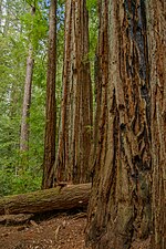
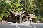
Portola Redwoods State Park is a 2,800 acres (1,100 ha) state park in California situated in San Mateo County. The parks' primary watercourses — Peters Creek, Pescadero Creek and their associated tributaries — converge at Portola Redwoods State Park. Tip Toe Falls is a small waterfall along Fall Creek, a tributary of Pescadero Creek. The indigenous Quiroste people, affiliated with the broader constellation of Ramaytush Ohlone communities based in the San Francisco Peninsula, were among the original inhabitants of Portola Redwoods State Park, where they obtained various species of fish, such as coho salmon and steelhead trout, along the waterways that wend along the region, and harvested asphaltum from Tar Creek. In addition, the Quiroste maintained trading networks with tribes further inland and exchanged a variety of coastal products, including beads cultivated from Olivella sea shells as a means of barter.In 1769, the Portola expedition entailed an overland journey from the Pacific coastline of San Mateo County to San Francisco Bay, presaging the advent of European-American settlement and colonization in the area. During the nineteenth-century California Gold Rush, the copious redwood groves were harvested for industrial purposes, such as mining and other construction enterprises. It was not until the 1860s, however, that the park was settled by Danish immigrant and lumberjack Christian Iverson, whose surname is commemorated by the titular Iverson trail today.By 1924, about 1,600 acres (650 ha) — about half of the park's contemporary size — was bequeathed to the Masonic Lodge, whose Shriners subsequently sold the land to the State of California, and Portola Redwoods State Park officially opened under the auspices of the California Department of Parks and Recreation in 1945. Owing to the fundraising efforts of such environmental organizations as Save the Redwoods League, the park was later enlarged to its current dimensions.Relatively remote and secluded, the park offers various recreational opportunities for visitors, including a variety of hiking trails ranging in length and difficulty. For instance, the 1.2 miles (1.9 km) roundtrip Old Tree Trail confers access to the eponymous redwood tree, renowned for its longevity (estimated at 1200 years) and height of over 300 feet (91 m). In addition, the longer Peters Creek Loop offers backpackers and hikers willing to traverse 11.9 miles (19.2 km) roundtrip the opportunity to witness some of the oldest and tallest redwoods in the San Francisco Bay Area.Portola Redwoods State Park contains approximately 18 miles of hiking trails in the 2,800-acre park, a small car-camping campground of about 50 campsites, four group campsites, and 6 trail sites at Slate Creek Trail Camp. Portola Redwoods State Park is also home to the site of Page shingle Mill, for which Page Mill Road is named.

Big Basin Redwoods State Park

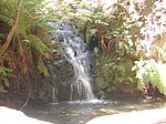
Big Basin Redwoods State Park is a state park in the U.S. state of California, located in Santa Cruz County, about 36 km (22 mi) northwest of Santa Cruz. The park contains almost all of the Waddell Creek watershed, which was formed by the seismic uplift of its rim, and the erosion of its center by the many streams in its bowl-shaped depression. Big Basin is California's oldest State Park, established in 1902, earning its designation as a California Historical Landmark. Its original 3,800 acres (15 km2) have been increased over the years to over 18,000 acres (73 km2). It is part of the Northern California coastal forests ecoregion and is home to the largest continuous stand of ancient coast redwoods south of San Francisco. It contains 10,800 acres (44 km2) of old-growth forest as well as recovering redwood forest, with mixed conifer, oaks, chaparral and riparian habitats. Elevations in the park vary from sea level to over 600 m (2,000 ft). The climate ranges from foggy and damp near the ocean to sunny, warm ridge tops. The park has over 130 km (81 mi) of trails. Some of these trails link Big Basin to Castle Rock State Park and the eastern reaches of the Santa Cruz range. The Skyline-to-the-Sea Trail threads its way through the park along Waddell Creek to Waddell Beach, and the adjacent Theodore J. Hoover Natural Preserve, a freshwater marsh.The park has many waterfalls, a wide variety of environments (from lush canyon bottoms to sparse chaparral-covered slopes), many species of mammals (deer, raccoons, an occasional bobcat) and abundant bird life – including Steller's jays, egrets, herons and acorn woodpeckers. The CZU Lightning Complex fires in August 2020 burned over 97% of Big Basin and destroyed the park headquarters, closing the park for 2 years during rebuilding efforts before it reopened in Summer 2022.