Muchelney Abbey

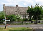
Muchelney Abbey is an English Heritage property in the village of Muchelney in the Somerset Levels, England. The site consists of ruined walls showing the layout of the abbey buildings constructed from the 7th to 16th centuries, and the remaining intact Abbot's House. It is next to the parish church in which some of the fabric of the abbey has been reused. It comprises the remains and foundations of a medieval Benedictine abbey, the site of an earlier Anglo-Saxon abbey, and an early Tudor house dating from the 16th century, formerly the lodgings of the resident Abbot, which is now a Grade I listed building. The ruins of the abbey have been designated as a scheduled monument.The abbey was founded in the 7th or 8th century, damaged by Viking raids and rebuilt and refounded in the 10th century. It owned and managed local land. The buildings were expanded from the 12th to 16th centuries until its dissolution in 1538. Most of the buildings were demolished and the stone used in local buildings, although the Abbot's House and reredorter survive. Some of the tiles and other decorative features from the monastic church were reused in the adjacent parish Church of St Peter and St Paul. Since 1927 the ruins have been in public ownership.
Excerpt from the Wikipedia article Muchelney Abbey (License: CC BY-SA 3.0, Authors, Images).Muchelney Abbey
Horsey Lane,
Geographical coordinates (GPS) Address External links Nearby Places Show on map
Geographical coordinates (GPS)
| Latitude | Longitude |
|---|---|
| N 51.020277777778 ° | E -2.8158333333333 ° |
Address
Muchelney Abbey
Horsey Lane
TA10 0DF
England, United Kingdom
Open on Google Maps


