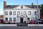
Clapham, Gloucester
Areas of GloucesterGloucestershire geography stubsHistory of Gloucester

Clapham was a district of the City of Gloucester that was developed from 1822 by George Worrall Counsel who built several hundred houses for artisans. It included Worrall Street and Counsel Street, neither of which now exist. The area was redeveloped in the twentieth century and is now part of Kingsholm.
Excerpt from the Wikipedia article Clapham, Gloucester (License: CC BY-SA 3.0, Authors, Images).Clapham, Gloucester
Clarence Row, Gloucester Kingsholm
Geographical coordinates (GPS) Address Nearby Places Show on map
Geographical coordinates (GPS)
| Latitude | Longitude |
|---|---|
| N 51.869 ° | E -2.241 ° |
Address
Clarence Row
Clarence Row
GL1 3AH Gloucester, Kingsholm
England, United Kingdom
Open on Google Maps


