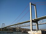
Benicia State Recreation Area
Bay Area Ridge TrailBenicia, CaliforniaCalifornia State Recreation AreasImportant Bird Areas of CaliforniaParks in Solano County, California ... and 2 more
Protected areas established in 1957San Francisco Bay Trail

Benicia State Recreation Area is a state park unit of California, United States, protecting tidal wetland. It is located in the Solano County city of Benicia, 2 miles (3.2 km) west of downtown Benicia and borders Vallejo's Glen Cove neighborhood. The park covers 447 acres (181 ha) of marsh, grassy hillsides and rocky beaches along the narrowest portion of the Carquinez Strait. Southampton Creek and the tidal marsh front Southampton Bay, where the combined waters of the Sacramento and San Joaquin Rivers approach San Pablo Bay, the northern portion of San Francisco Bay.
Excerpt from the Wikipedia article Benicia State Recreation Area (License: CC BY-SA 3.0, Authors, Images).Benicia State Recreation Area
Dillon Point Road,
Geographical coordinates (GPS) Address Nearby Places Show on map
Geographical coordinates (GPS)
| Latitude | Longitude |
|---|---|
| N 38.073611111111 ° | E -122.19305555556 ° |
Address
Southampton Bay Wetland Natural Preserve
Dillon Point Road
94569
California, United States
Open on Google Maps


