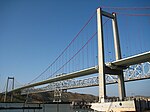
Carquinez Strait

The Carquinez Strait (; Spanish: Estrecho de Carquinez) is a narrow tidal strait located in the Bay Area of Northern California, United States. It is part of the tidal estuary of the Sacramento and the San Joaquin rivers as they drain into the San Francisco Bay. The strait is eight miles (13 km) long and connects Suisun Bay, which receives the waters of the combined rivers, with San Pablo Bay, a northern extension of the San Francisco Bay. The strait formed in prehistoric times, near the close of one of the past ice ages, when the Central Valley was a vast inland lake. Melting ice from the Sierra Nevada raised the water level while seismic activity created a new outlet to the Pacific Ocean, draining the lake into the ocean and exposing the valley floors.
Excerpt from the Wikipedia article Carquinez Strait (License: CC BY-SA 3.0, Authors, Images).Carquinez Strait
Loring Avenue,
Geographical coordinates (GPS) Address Nearby Places Show on map
Geographical coordinates (GPS)
| Latitude | Longitude |
|---|---|
| N 38.05918 ° | E -122.2126 ° |
Address
Loring Avenue
Loring Avenue
94525
California, United States
Open on Google Maps


