place

Tilden Park Golf Course

California sports venue stubsGolf club and course stubsGolf clubs and courses in CaliforniaSports venues in Berkeley, California

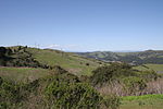
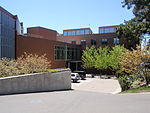
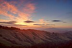
The Tilden Park Golf Course is a public golf course in the San Francisco Bay Area.

Excerpt from the Wikipedia article Tilden Park Golf Course (License: CC BY-SA 3.0, Authors).

Tilden Park Golf Course
Golf Course Drive, Berkeley

Geographical coordinates (GPS) Address Website Nearby Places
placeShow on map

Wikipedia: Tilden Park Golf CourseContinue reading on Wikipedia

Geographical coordinates (GPS)

Latitude Longitude
N 37.888 ° E -122.243 °
placeShow on map

Address

Tilden Golf Course

Golf Course Drive
94708 Berkeley
California, United States
mapOpen on Google Maps

Website
tildenparkgc.com

linkVisit website

Share experience

Nearby Places

1923 Berkeley, California fire

The 1923 Berkeley Fire was a conflagration that consumed some 640 structures, including 584 homes in the densely-built neighborhoods north of the campus of the University of California in Berkeley, California on September 17, 1923. Although the exact cause was never determined, the fire began in the undeveloped chaparral and grasslands of Wildcat Canyon, just east of the ridgeline of the Berkeley Hills, and was propelled over the ridge and southwestward just south of Codornices Creek by a strong, gusty, and intensely dry northeasterly wind. The fire quickly blew up as it swept through the La Loma Park and Northside neighborhoods of Berkeley, overwhelming the capabilities of the Berkeley Fire Department to stop it. A number of UC students fought the advance of the fire as it approached the north edge of the University of California campus, at Hearst Avenue. The other edge of the fire was fought by firefighters as it advanced on downtown Berkeley along the east side of Shattuck Avenue north of University Avenue. Firefighters were rushed in from neighboring Oakland, and San Francisco sent firefighters by ferry across the bay. Firefighting efforts were hampered by the inadequacy of water mains in northern Berkeley, where rapid development after the 1906 San Francisco earthquake had outgrown the water supply in the fire area. Firefighters trying to fight the fire connected to hydrants in the area that hissed dry and were hampered also by the predominance of cedar shake roofs. The strong and dry wind lifted burning shakes off burning houses and quickly spread the fire. The fire was halted only when the northeasterly winds died down and were replaced by the cool, humid afternoon sea breeze. The fire lines were established at Hearst and Shattuck Avenues, where larger diameter water mains delivered a reliable water supply for firefighting. Building styles in North Berkeley changed dramatically after the 1923 fire, with stucco and tile roof homes largely, but not entirely, replacing the wood-sided and cedar-shaked construction styles popularized by the Berkeley Hillside Club before the fire.As a belated result of the fire, the City of Berkeley constructed a fire station in the hills at 2931 Shasta Road (at Queens Road) just below Grizzly Peak Blvd, in 1948. In the early 2000s, this station was replaced and relocated to a nearby site just above Grizzly Peak Blvd. at 3000 Shasta Road, on the interface between the residential area and Tilden Regional Park, very close to the putative origin of the 1923 fire.

Grizzly Peak (Berkeley Hills)

Grizzly Peak is a summit in the Berkeley Hills above Berkeley, California. The peak is located on the border between Alameda and Contra Costa counties, within the boundaries of Tilden Regional Park, and directly behind the University of California, Berkeley campus. The peak was named for the California grizzly bear which inhabited the local area until the late 1800s. The last sighting locally was by a man who was reportedly killed by a grizzly in Strawberry Canyon below Grizzly Peak in the 1860s. The first local killing of a grizzly by a European occurred in 1772, also along Strawberry Creek just west of what is today the UC Berkeley campus, within what is now downtown Berkeley. The shooting by Spanish soldiers was recorded by Father Juan Crespi. The last grizzly in all of California was killed in the Sierra foothills east of Fresno in August 1922.Grizzly Peak became more accessible in 1932 when Grizzly Peak Boulevard was constructed along the ridge line of the Berkeley Hills. The name was extended to the previously-constructed ridge line stretch of Euclid Avenue to the north shortly thereafter. This portion was and remains a residential area of Berkeley while the original stretch is largely undeveloped. Grizzly Peak Boulevard now extends from Kenyon Avenue in Kensington in the north, through Berkeley and Oakland to an intersection with Skyline Blvd. above Oakland to the south. Before Grizzly Peak Boulevard was constructed, the location of its current intersection with Claremont (before 1892 known as Telegraph Road) and Fish Ranch Road was historically an important pass through the Berkeley Hills, before the tunnel that preceded today's Caldecott Tunnel was constructed through the hills in 1903; an inn and stage stop called the Summit House was located here. Today, Grizzly Peak is a popular location for people to get a unique view of the Golden Gate Bridge and the surrounding Bay Area. It is also common to see street luge enthusiasts in this area and down the canyon into Berkeley from Skyline Boulevard and Claremont Avenue.