place

Richmond, California

1905 establishments in CaliforniaCities in Contra Costa County, CaliforniaCities in the San Francisco Bay AreaFire departments needing logosIncorporated cities and towns in California
Populated coastal places in CaliforniaPopulated places established in 1905Port cities in CaliforniaRichmond, CaliforniaUse mdy dates from March 2022
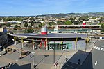
Richmond California aerial (cropped)

Richmond is a city in western Contra Costa County, California, United States. The city was incorporated on August 7, 1905, and has a city council. Located in the San Francisco Bay Area's East Bay region, Richmond borders San Pablo, Albany, El Cerrito and Pinole in addition to the unincorporated communities of North Richmond, Hasford Heights, Kensington, El Sobrante, Bayview-Montalvin Manor, Tara Hills, and East Richmond Heights, and for a short distance San Francisco on Red Rock Island in the San Francisco Bay. Richmond is one of two cities, the other being San Rafael, that sits on the shores of both San Francisco Bay and San Pablo Bay. Its population was 116,448 as of the 2020 census.

Excerpt from the Wikipedia article Richmond, California (License: CC BY-SA 3.0, Authors, Images).

Richmond, California
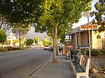
Macdonald Avenue, Richmond

Geographical coordinates (GPS) Address Nearby Places
placeShow on map

Wikipedia: Richmond, CaliforniaContinue reading on Wikipedia

Geographical coordinates (GPS)

Latitude Longitude
N 37.935833333333 ° E -122.34777777778 °
placeShow on map

Address

Wig and Wear Center

Macdonald Avenue 2235
94801 Richmond
California, United States
mapOpen on Google Maps

Richmond California aerial (cropped)
Share experience

Nearby Places

Richmond station (California)

Richmond station (officially the Richmond Transit Center) is an Amtrak intercity rail and Bay Area Rapid Transit (BART) station located in downtown Richmond, California. Richmond is the north terminus of BART service on the Orange Line and Red Line; it is a stop for Amtrak's Capitol Corridor, San Joaquins, and California Zephyr routes. The accessible station has one island platform for the two BART tracks, with a second island platform serving two of the three tracks of the Union Pacific Railroad Martinez Subdivision for Amtrak trains. It is one of two transfer points between BART and Amtrak, along with Oakland Coliseum station. The Southern Pacific (SP)-controlled Northern Railway opened through what is now Richmond in 1878. A flag stop at Barrett's Station was established by the mid-1880s; it was renamed Richmond in 1902 during the town's rapid growth. The SP constructed a new station at Richmond in 1904 and again in 1914–15. The SP station was demolished around 1968, though passenger continued until the formation of Amtrak in 1971. The modern station opened on January 29, 1973, as the northern terminal of BART service. Controversies during planning included the station location and the design of the concourse. Amtrak service to the station began on October 30, 1977. A new Amtrak platform was built in 2001, followed by a renovation of the whole station completed in 2007. A parking garage replaced the surface parking lot in 2013.