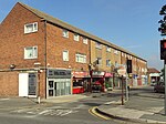
The Puddydale
Merseyside geography stubsParks and commons in the Metropolitan Borough of Wirral

The Puddydale is a park and grassy area in Heswall, Wirral, England. It is on Telegraph Road, close to the main shopping area of Heswall. The land was given to the parish in 1859 by the Commissioners of Enclosure. It was previously the site of a lake, drained in 1922, and later became a rubbish tip; since 1932 it has been a playing field. It includes a children's playground. Local football teams use the site.The eastern side of The Puddydale was originally the site of Heswall Primary School from 1909 to 1982, but is now the site of residential flats.
Excerpt from the Wikipedia article The Puddydale (License: CC BY-SA 3.0, Authors, Images).The Puddydale
Telegraph Road, Wirral
Geographical coordinates (GPS) Address Nearby Places Show on map
Geographical coordinates (GPS)
| Latitude | Longitude |
|---|---|
| N 53.3298 ° | E -3.1005 ° |
Address
Telegraph Road
CH60 7RN Wirral
England, United Kingdom
Open on Google Maps


