place

Ilketshall St Andrew

Civil parishes in SuffolkEast Suffolk (district)Round towersUse British English from July 2016Villages in Suffolk
Waveney District
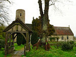
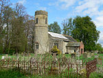
St Andrew's church Ilketshall St Andrew Suffolk (4970160657)

Ilketshall St Andrew is a village and civil parish in the north of the English county of Suffolk. It is 3 miles (4.8 km) south-east of Bungay and the same distance south-west of Beccles in the East Suffolk district. St Andrew's church is one of around 40 round-tower churches in Suffolk. The parish had a population of 291 at the 2011 United Kingdom census. It is one of a group around Bungay known as The Saints, and is located east of the A144 road between Bungay and Halesworth. The parish borders the parishes of Shipmeadow, Ringsfield, Redisham, Westhall, Spexhall, Ilketshall St Lawrence and Ilketshall St John.

Excerpt from the Wikipedia article Ilketshall St Andrew (License: CC BY-SA 3.0, Authors, Images).

Ilketshall St Andrew
School Road, East Suffolk St Andrew, Ilketshall

Geographical coordinates (GPS) Address Nearby Places
placeShow on map

Wikipedia: Ilketshall St AndrewContinue reading on Wikipedia

Geographical coordinates (GPS)

Latitude Longitude
N 52.431 ° E 1.498 °
placeShow on map

Address

School Road

School Road
NR34 8HX East Suffolk, St Andrew, Ilketshall
England, United Kingdom
mapOpen on Google Maps

St Andrew's church Ilketshall St Andrew Suffolk (4970160657)
Share experience

Nearby Places

Ilketshall St Lawrence

Ilketshall St Lawrence is a village and civil parish in the East Suffolk district of the English county of Suffolk. It is 3 miles (4.8 km) south-east of the market town of Bungay and is part of a group of parishes with similar names known collectively as the Saints. The parish is spread along a 3 miles (4.8 km) stretch of the A144 road which runs between Bungay and Halesworth. It has an elongated shape, with the parish church located close to the northern border of the parish and the village school, Ilketshall St Lawrence primary school, located close to the southern border. At the 2011 United Kingdom census the parish had a population of 158. It has an area of 5 square kilometres (1.9 sq mi) and borders the parishes of Ilketshall St Andrew, Ilketshall St John, Ilketshall St Margaret and Spexhall. Other than the school and the parish church, there are few services in the village. A garage and petrol station are located on the main road and an apple juice and cider making business operates from the parish. A public house, the Huntsman and Hounds, lies just south of the parish boundary in the hamlet of Stone Street, part of Spexhall parish. The parish church, which is dedicated to St Lawrence, dates from the 12th-century, although there was a church on the site at the time of the Domesday Book. The tower dates from the 15th-century. The church is a Grade II* listed building and is believed to be built on a Roman site, with pottery found in the grounds in 1929.

The Saints, Suffolk

The Saints are a group of villages in the north of the English county of Suffolk, between the rivers Blyth and Waveney near to the border with Norfolk. The villages are all named after a saint (that of their parish church), and either South Elmham or Ilketshall named after the 'hall of Alfkethill'. Known by locals as 'up the Parishes' the area is found between the market towns of Halesworth, Harleston, Bungay and Beccles. South Elmham comes from the Anglo-Saxon "hamlet where elms grew" and is first mentioned in Domesday Book as Almeham; North Elmham is in Norfolk, 30 miles (48 km) away. The Saints are: All Saints' South Elmham St Cross South Elmham (also known as Sancroft St George, and Sancroft). St James South Elmham St Margaret South Elmham St Mary, South Elmham (also known as Homersfield) St Michael South Elmham St Nicholas South Elmham (church no longer present) St Peter South Elmham Ilketshall St Andrew Ilketshall St John Ilketshall St Lawrence Ilketshall St Margaret Flixton is generally grouped within the Saints Rumburgh Priory is historically connected with the Saints churches and is less than 1km from All Saints South Elmham Each of the villages also constitutes a civil parish, apart from All Saints and St Nicholas, which are joined together in the All Saints and St Nicholas, South Elmham parish. St Michael is one of the Thankful Villages. It is unclear whether North Elmham in Norfolk or South Elmham in Suffolk is the site of East Anglia's second See ("Helmham"), founded in the reign of King Ealdwulf (c.664-713) according to Bede. The Saints is the setting for much of Michael Ondaatje's Warlight, a mystery set in the 1950s in which the area is described as having a unique culture.