Mount Evans Scenic Byway
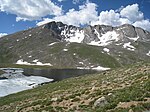
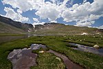
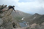
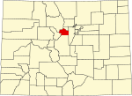
The Mount Evans Scenic Byway is a 49-mile (79 km) National Forest Scenic Byway and Colorado Scenic and Historic Byway located in Clear Creek and Jefferson counties, Colorado, United States. The byway ascends to 14,140 feet (4,310 m) of elevation near the 14,271-foot (4,350 m) summit of Mount Blue Sky, making it the highest paved road in North America (beating the 14,115-foot (4,302 m) Pikes Peak Highway by only 25 feet (8 m).) The byway visits Echo Lake Park, the Mount Goliath Natural Area, the Dos Chappell Nature Center, and Summit Lake Park on its way to the summit. A fee is charged to travel State Highway 5 to the summit and vehicles over 30 feet (9.1 m) long are not allowed, although they are allowed on State Highway 103 which reaches its highest elevation of 11,020 feet (3,359 m) at Juniper Pass. The byway connects to the Lariat Loop Scenic and Historic Byway at Bergen Park.
Excerpt from the Wikipedia article Mount Evans Scenic Byway (License: CC BY-SA 3.0, Authors).Mount Evans Scenic Byway
Mount Blue Sky Summit Trail,
Geographical coordinates (GPS) Address Nearby Places Show on map
Geographical coordinates (GPS)
| Latitude | Longitude |
|---|---|
| N 39.5883 ° | E -105.6438 ° |
Address
Mount Blue Sky Summit Trail
Mount Blue Sky Summit Trail
Colorado, United States
Open on Google Maps


