White River National Forest

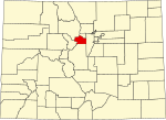
White River National Forest is a National Forest in northwest Colorado. It is named after the White River that passes through its northern section. It is the most visited National Forest in the United States, primarily from users of the twelve ski areas within its boundaries. The forest contains 2,285,970 acres (3,571.8 sq mi, or 9,250.99 km²). In descending order of land area it is located in parts of Eagle, Pitkin, Garfield, Summit, Rio Blanco, Mesa, Gunnison, Routt, and Moffat counties.The White River National Forest provides significant habitat for deer, elk, mountain sheep, mountain goat, bear, mountain lion, bobcat, lynx, moose, raptors, waterfowl, trout and many other species of wildlife. The forest contains 1,900 mi. (3,058 km) of forest system roads, 2,500 mi (4,023 km) of trails, and the Dillon, Green Mountain, Ruedi, and Homestake reservoirs. The forest is managed from Forest Service offices in Glenwood Springs. There are local ranger district offices in Aspen, Carbondale, Eagle, Meeker, Minturn, Rifle, and Silverthorne. The Dillon Ranger district, run out of Silverthorne, was transferred from the Arapahoe National Forest to the White River National Forest in 1998.
Excerpt from the Wikipedia article White River National Forest (License: CC BY-SA 3.0, Authors, Images).White River National Forest
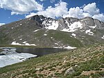
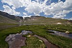
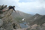
Mount Blue Sky Summit Trail,
Geographical coordinates (GPS) Address Nearby Places Show on map
Geographical coordinates (GPS)
| Latitude | Longitude |
|---|---|
| N 39.589 ° | E -105.643 ° |
Address
Mount Blue Sky Summit Trail
Mount Blue Sky Summit Trail
Colorado, United States
Open on Google Maps


