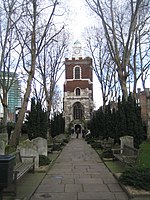
Bow Bridge, London

Bow Bridge was a stone bridge built over the River Lea, in what is now London, in the twelfth century. It took its name from the distinctively bow-shaped (curved) arches. It linked Bow in Middlesex with Stratford in Essex. The name has also been applied to replacement structures, with the current structure also, and more commonly, known as Bow Flyover. The Roman Road from Aldgate to Essex and East Anglia had previously forded the Lea further north, half a mile upstream, at Old Ford; the new crossing led the highway to take a more southerly route. The road is known by various names throughout its length, for instance Bow Road (in Bow) and High Street and Romford Road in Stratford, while the whole road was long known as the Great Essex Road. Prior to the construction of the first bridge, settlements on both sides of the river were known as Stratford. Afterwards, the western Stratford settlement become suffixed by “-atte-Bow” (at the Bow), eventually becoming known simply as Bow. The eastern Stratford became suffixed by "Langthorne" after a large and notable tree, but lost that suffix over time and is now know simply as Stratford. There was a battle at Bow Bridge, on 4th June 1648, during the Wars of the Three Kingdoms.
Excerpt from the Wikipedia article Bow Bridge, London (License: CC BY-SA 3.0, Authors, Images).Bow Bridge, London
Bow Roundabout, London Bow
Geographical coordinates (GPS) Address Nearby Places Show on map
Geographical coordinates (GPS)
| Latitude | Longitude |
|---|---|
| N 51.529711111111 ° | E -0.013625 ° |
Address
Bow Roundabout
Bow Roundabout
E15 2GR London, Bow
England, United Kingdom
Open on Google Maps


