place

Long Island City

Central business districts in New York CityFormer cities in New York CityFormer county seats in New York (state)Long Island CityNRHP infobox with nocat
Neighborhoods in Queens, New YorkUse mdy dates from June 2020
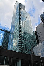
Long Island City from One World Observatory 2017

Long Island City (LIC) is a residential and commercial neighborhood on the extreme western tip of Queens, a borough in New York City. It is bordered by Astoria to the north; the East River to the west; Hazen Street, 49th Street, and New Calvary Cemetery in Sunnyside to the east; and Newtown Creek—which separates Queens from Greenpoint, Brooklyn—to the south. Incorporated as a city in 1870, Long Island City was originally the seat of government of the Town of Newtown, before becoming part of the City of Greater New York in 1898. In the early 21st century, Long Island City became known for its rapid and ongoing residential growth and gentrification, its waterfront parks, and its thriving arts community. The area has a high concentration of art galleries, art institutions, and studio space.Long Island City is the eastern terminus of the Queensboro Bridge, the only non-tolled automotive route connecting Queens and Manhattan. Northwest of the bridge are the Queensbridge Houses, a development of the New York City Housing Authority and the largest public housing complex in the Western Hemisphere. Long Island City is part of Queens Community District 1 to the north and Queens Community District 2 to the south. It is patrolled by the New York City Police Department's 108th Precinct. Politically, Long Island City is represented by the New York City Council's 26th District.

Excerpt from the Wikipedia article Long Island City (License: CC BY-SA 3.0, Authors, Images).

Long Island City
Queensboro Bridge Outer Roadway, New York Queens

Geographical coordinates (GPS) Address Nearby Places
placeShow on map

Wikipedia: Long Island CityContinue reading on Wikipedia

Geographical coordinates (GPS)

Latitude Longitude
N 40.7509 ° E -73.9411 °
placeShow on map

Address

Queensboro Plaza

Queensboro Bridge Outer Roadway
11101 New York, Queens
New York, United States
mapOpen on Google Maps

Long Island City from One World Observatory 2017
Share experience

Nearby Places

Queensboro Plaza station

The Queensboro Plaza station (originally named Queensboro Bridge Plaza station or simply Bridge Plaza station) is an elevated New York City Subway station at Queens Plaza (originally called Queensboro Bridge Plaza or simply Bridge Plaza) in the Long Island City neighborhood of Queens. It is near the east end of the Queensboro Bridge, with Queens Boulevard running east from the plaza. The station is served by the 7 and N trains at all times, the W train on weekdays, and the <7> train rush hours in the peak direction. Queensboro Plaza was originally built in 1916–1917 as part of the Dual Contracts between the Brooklyn–Manhattan Transit Corporation (BMT) and the Interborough Rapid Transit Company (IRT). The station initially had eight tracks to allow BMT and IRT passengers to transfer between the Astoria, Flushing, and Second Avenue elevated lines. The northern section of the station was closed in the late 1940s and demolished in 1964. Queensboro Plaza now contains only four tracks: two each for the IRT Flushing Line (7 and <7>​ trains) and the BMT Astoria Line (N and ​W trains). Today, Queensboro Plaza is the only station in the entire system to provide cross-platform transfers between "A" Division (7 and <7>​) and "B" Division (N and ​W) trains. While the station is near the Queens Plaza underground subway station, which serves the IND Queens Boulevard Line, the two stations are separate and do not allow free transfers.