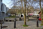
Plymouth (pronounced as Plimeth; ) is a port city and unitary authority in Devon, South West England. It is located on the south coast of Devon, approximately 36 miles (58 km) southwest of Exeter and 193 miles (311 km) southwest of London. It is bordered by Cornwall to the west and southwest.
Plymouth's early history extends to the Bronze Age when a settlement emerged at Mount Batten, which was a trading post for the Roman Empire. By the ninth century Mount Batten had been surpassed by the village of Sutton on the opposite side of the mouth of the River Plym. Sutton was granted a charter making it a market town in 1254. As Sutton grew it also became known as Plymouth, with the change of name being formalised in 1439 when it was made a borough.
In 1588, an English fleet based in Plymouth intercepted and defeated the Spanish Armada. In 1620, the Pilgrim Fathers departed Plymouth for the New World and established Plymouth Colony, the second English settlement in what is now the United States of America. During the English Civil War, the town was held by the Parliamentarians and was besieged between 1642 and 1646.
Throughout the Industrial Revolution, Plymouth grew as a commercial shipping port, handling imports and passengers from the Americas, and exporting local minerals (tin, copper, lime, china clay and arsenic). From 1690 onwards a new dock for the Royal Navy was built on the banks of the River Tamar, 2 miles (3.2 km) west of Plymouth, around which grew a town called "Plymouth Dock", renamed Devonport in 1824. In 1914 Devonport and the neighbouring town of East Stonehouse were absorbed into the borough of Plymouth. Plymouth was awarded city status in 1928.
During World War II, due to the city's naval importance, the German military targeted and partially destroyed the city by bombing, an act known as the Plymouth Blitz. After the war, the city centre was completely rebuilt. Subsequent expansion led to the incorporation of Plympton, Plymstock, and other outlying suburbs, in 1967.
The city is home to 264,727 (2021) people, making it the 30th-most populous built-up area in the United Kingdom and the second-largest city in the South West, after Bristol. It is governed locally by Plymouth City Council and is represented nationally by two MPs. Plymouth's economy remains strongly influenced by shipbuilding and seafaring but has tended toward a service economy since the 1990s. It has ferry links to Brittany (Roscoff and St Malo) and to Spain (Santander). It has the largest operational naval base in Western Europe, HMNB Devonport, and is home to the University of Plymouth. Plymouth is categorized as a Small-Port City using the Southampton System for port-city classification.
