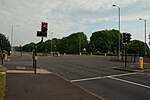
Patshull
Former civil parishes in StaffordshireSouth Staffordshire DistrictStaffordshire geography stubsVillages in Staffordshire

Patshull is a former civil parish, now in the parish of Pattingham and Patshull, in the South Staffordshire district, in the county of Staffordshire, England. It is 7 miles west of Wolverhampton and 7½ miles east of Bridgnorth. According to the 2011 census it had a population of 212. The parish consisted of Patshull, Burnhill Green and, along its eastern boundary, Westbeech (old name Westbach). It formerly contained several farmhouses and small cottages, but Burnhill Green is the main hamlet.
Excerpt from the Wikipedia article Patshull (License: CC BY-SA 3.0, Authors, Images).Patshull
Home Farm Road,
Geographical coordinates (GPS) Address Nearby Places Show on map
Geographical coordinates (GPS)
| Latitude | Longitude |
|---|---|
| N 52.6058 ° | E -2.2935 ° |
Address
Home Farm Road
Home Farm Road
WV6 7HX
England, United Kingdom
Open on Google Maps


