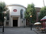
place

Worcester, England

Cities in the West Midlands (region)County towns in EnglandHarv and Sfn no-target errorsLocal government in WorcestershireNon-metropolitan districts of Worcestershire
Pages including recorded pronunciationsPopulated places on the River SevernTowns in WorcestershireUse British English from September 2010Worcester, England
Worcester from Fort Royal Hill

Worcester ( (listen) WUUS-tər) is a cathedral city and the ceremonial county town of Worcestershire, England, 30 miles (48 km) south-west of Birmingham, 101 miles (163 km) north-west of London, 27 miles (43 km) north of Gloucester and 23 miles (37 km) north-east of Hereford. The estimated population in 2019 was 102,791.The River Severn flanks the western side of the city centre. It is overlooked by Worcester Cathedral. Worcester is the home of Royal Worcester Porcelain, composer Edward Elgar, Lea & Perrins, makers of traditional Worcestershire sauce, the University of Worcester, and Berrow's Worcester Journal, claimed as the world's oldest newspaper. The Battle of Worcester in 1651 was the final one in the English Civil War, where Oliver Cromwell's New Model Army defeated King Charles II's Royalists.

Excerpt from the Wikipedia article Worcester, England (License: CC BY-SA 3.0, Authors, Images).

Worcester, England
Shambles Entry, Worcester, England Red Hill

Geographical coordinates (GPS) Address Nearby Places
placeShow on map

Wikipedia: Worcester, EnglandContinue reading on Wikipedia

Geographical coordinates (GPS)

Latitude Longitude
N 52.192 ° E -2.22 °
placeShow on map

Address

Marks & Spencer

Shambles Entry
WR1 2QN Worcester, England, Red Hill
England, United Kingdom
mapOpen on Google Maps

Worcester from Fort Royal Hill
Share experience

Nearby Places

Worcester city walls

Worcester's city walls are a sequence of defensive structures built around the city of Worcester in England between the 1st and 17th centuries. The first walls to be built around Worcester were constructed by the Romans. These early walls lasted beyond the fall of the Empire, and the defences encouraged several early Christian foundations to establish themselves in Worcester during the troubled 6th and 7th centuries. The Anglo-Saxons expanded Worcester in the 890s, forming a new walled, planned city, called a burh. The burh utilised the southern stretches of the old Roman walls, but pushed further north to enclose a much larger area. The Anglo-Saxon city walls were maintained by a share of taxes on a local market and streets, in an agreement reinforced by a royal charter. After the Norman conquest of England in the 11th century a motte and bailey castle was constructed on the south side of the city, but the Norman rulers continued to use the older burh walls, despite the city having expanded beyond these defences in the north and south-east. During the years of the Anarchy in the 1140s, Worcester was successfully attacked several times; after the war a new city wall was built to improve the city's defences. The new walls, completed by the early 13th century, were constructed of stone and had three main gates. They were maintained in good condition into the 17th century. During the English Civil War in the 1640s the old medieval walls were reinforced with modern earthwork bastions and an outlying fort, called a sconce. Worcester changed hands several times during the conflict, and after the war ended the newer fortifications were dismantled. During the 18th century the older medieval stone walls and gatehouses were sold and mostly destroyed: by the 20th century, few parts survived. Post-war archaeology in the 1950s and 1960s and construction work in the 1970s revealed previously hidden stretches of the wall, and in the 21st century plans have been drawn up to improve the conservation and maintenance of this historic monument.

Worcester Boer War Memorial

The Worcester Boer War Memorial in Worcester, England, was unveiled near Worcester Cathedral in 1908. The war memorial commemorates casualties of the Second Boer War from the county of Worcestershire. It was designated a Grade II* listed building in 1999. The memorial comprises a bronze sculptural group mounted on an octagonal Portland stone plinth and base, standing on three steps. The front of the plinth bears the inscription: 'IN GRATEFUL / MEMORY OF / THE MEN OF / WORCESTER-/ SHIRE WHO IN / SOUTH AFRICA / GAVE THEIR / LIVES FOR THEIR / COUNTRY. / A.D.1899-1902." A further inscription on the stone base quotes from Ecclesiasticus: "Their bodies are buried in peace; / but their name liveth for evermore. Ecclus XLIV 14" The bronze sculpture by William Robert Colton depicts a soldier of the Worcestershire Regiment, bare-headed and bare-armed, with a bandolier of bullets, kneeling with a bayonet affixed to his rifle held in a high "ready" position, in front of a standing winged female figure (various in various sources as an angel, or a Winged Victory, or a personification of "Immortality") with her left hand gripping a sheathed sword girt with a laurel wreath and the right holding an olive branch (or possibly a palm branch) over the head of the soldier. The memorial was unveiled on 23 September 1908 by General Sir Neville Lyttelton, on a site to the north of Worcester Cathedral. It stands close to the passing A44.