place

Falls of the Ohio National Wildlife Conservation Area

1981 establishments in Indiana1981 establishments in Kentucky1981 in paleontologyClarksville, IndianaHistory of Louisville, Kentucky
Landforms of Louisville, KentuckyNational Natural Landmarks in IndianaNational Natural Landmarks in KentuckyOhio RiverPortages in the United StatesProtected areas established in 1981Protected areas of Clark County, IndianaProtected areas of Jefferson County, KentuckyTourist attractions in Louisville, KentuckyWaterfalls of Indiana
Fossil beds on the Ohio River

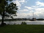
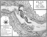
The Falls of the Ohio National Wildlife Conservation Area is a national, bi-state area on the Ohio River near Louisville, Kentucky in the United States, administered by the U.S. Army Corps of Engineers in partnership with Indiana Department of Natural Resources. Federal status was awarded in 1981. The falls were designated a National Natural Landmark in 1966.

Excerpt from the Wikipedia article Falls of the Ohio National Wildlife Conservation Area (License: CC BY-SA 3.0, Authors, Images).

Falls of the Ohio National Wildlife Conservation Area
Woodland Loop,

Geographical coordinates (GPS) Address Nearby Places
placeShow on map

Wikipedia: Falls of the Ohio National Wildlife Conservation AreaContinue reading on Wikipedia

Geographical coordinates (GPS)

Latitude Longitude
N 38.27665 ° E -85.76544 °
placeShow on map

Address

Woodland Loop

Woodland Loop

Indiana, United States
mapOpen on Google Maps

Fossil beds on the Ohio River
Share experience

Nearby Places

Camp Joe Holt
Camp Joe Holt

Camp Joe Holt was a Union base during the American Civil War in Jeffersonville, Indiana, across the Ohio River from Louisville, Kentucky, on land that is now part of Clarksville, Indiana, near the Big Eddy. It was a major staging area for troops in the Western Theatre of the War, in preparation for invading the Confederate States of America. Its establishment was the first major step performed by Kentucky Unionists to keep Kentucky from seceding to the Confederacy. Built on land leased from Colonel S. H. Patterson, it was named in honor of Joseph Holt, who became Buchanan's Secretary of War for about 60 days after John B. Floyd resigned. Holt strongly supported the Union. Colonel Lovell Rousseau opened the facility in June 1861 in order to recruit Kentuckians, mostly Louisvillians, into the Union Army. A pine board with the words Camp Joe Holt was nailed into a tree by the entrance to the camp on the second day of operations by a Captain Trainor. The Camp was built in Indiana due to fears that recruiting camps in Kentucky would encourage Kentucky to secede to the Confederacy. (A Confederate state government would eventually form in Kentucky, but the Union state government never dissolved.) By early September 1861, he had recruited over 2,000 such individuals, which formed the Fifth Kentucky Volunteer Infantry Regiment, nicknamed the Louisville Legion.The 49th Indiana Infantry was organized at Camp Joe Holt by Colonel John W. Ray, a former city councilman of Jeffersonville. Assisting him in the endeavor was the former member of the Clark Guards, Lieutenant Colonel James Keigwin. This was the only regiment formed in Clark County, Indiana.Camp Joe Holt would serve as a rendezvous hospital in 1862 until February 1864 when Jefferson General Hospital was opened in Port Fulton, Indiana, 1.5 miles upstream. It then reverted to a camp until the end of the war. Mr. Patterson reserved the right to remove the government chapel which would later become St. Paul's Episcopal Church.

Falls of the Ohio State Park

Falls of the Ohio State Park is a state park in the U.S. state of Indiana. It is located on the banks of the Ohio River at Clarksville, Indiana, across from Louisville, Kentucky. The park is part of the Falls of the Ohio National Wildlife Conservation Area. The exposed fossil beds of the Jeffersonville Limestone dated from the Devonian period are the main feature of the park, attracting about 160,000 visitors annually. The Falls was the site where Lewis and Clark met for the Lewis and Clark Expedition at George Rogers Clark's cabin. The park includes an interpretive center open to the public. In 1990, the Indiana state government hired Terry Chase, a well-established exhibit developer, to design the center's displays. Construction began in September 1992, costing $4.9 million with a total area of 16,000 sq ft (1,500 m2). The center functions as a museum with exhibits that concentrate on the natural history related to findings in the nearby fossil beds as well as the human history of the Louisville area, covering pre-settlement, early settlement, and the history of Louisville and southern Indiana through the 20th century. Unlike at other Indiana state parks, annual entrance permits do not allow unlimited free access (rather, only five people per pass per visit) to the interpretive center, as fees are still needed to reimburse the town of Clarksville for building the center. The Woodland Loop Trail features ten stainless steel markers denoting the plant life of the trails, thanks to an Eagle Scout project.Strange wildlife has been seen in the park, including alligators and crocodiles. Humorously, in August 2006, a fisherman hooked a dead octopus, but Zachary Treitz, a 21-year-old Louisville college student, admitted he had put the octopus there after purchasing it dead from a local seafood shop for a film project.

Shippingport, Kentucky

Shippingport, Kentucky is an industrial site and one of the six formerly independent settlements at the Falls of the Ohio in what is now Louisville, Kentucky. It was located on a peninsula on the south bank of the Ohio River, and incorporated without a name on October 10, 1785. It was later named Campbell Town after Revolutionary War soldier and settler John Campbell. He had been granted the land for his earlier service in the French & Indian War. In 1803 the settlement was sold to a Philadelphia-based partnership and renamed Shippingport. Two Tarascon brothers became leaders of the French business community at the Falls, building a large warehouse, a 1200-foot rope walk, and a six-story water-powered flour mill at the site by 1819. Numerous French families settled in the area, making it a center of French culture for a time. Some of the French settlers came from Kaskaskia, Illinois, and other areas of French settlement along the Mississippi River after the United States completed the Louisiana Purchase in 1803. Others were fleeing the French Revolution and its violence and political chaos, or social unrest in French colonies in the Caribbean. In 1804 former slaves succeeded in gaining independence for Haiti (formerly the French colony of Saint-Domingue) after years of warfare and violence.Among the early streets was Tarascon, named for the two French brothers who built up early development; and Bengal, perhaps named for a French settler and schoolteacher who came from Bengal via Calcutta and had first settled in Paris, Kentucky. From 1810 to 1820 the population increased 500%, from 98 to over 500, and this seriously challenged Louisville as Kentucky's most important port. Other early features included Elm Tree Garden, where there was horse-racing, and the Napoleon Distillery. The Tarascons' six-story flour mill built in 1817 became a symbol of Shippingport's success.Though the town frequently flooded, Shippingport reached its peak in the 1820s with a population of 600. In 1825, construction of the Louisville and Portland Canal across the peninsula left the settlement on an island. Using the canal, ships could bypass the Falls and, by extension, Shippingport. Shippingport was hard hit by the loss of its traditional business. In 1828, Louisville incorporated as a city and included Shippingport in its boundaries. But a bad flood in 1832 was the reason most of the French community moved to Portland, now also part of Louisville (it was then northwest of the larger city). The introduction to the Louisville Directory of 1844 expressed lingering negative public sentiment toward the canal: "The Louisville and Portland Canal, as constructed and maintained, is precisely one of those improvements for private interests, at the expense of the public good, which is obnoxious to the good of the whole community".The remnants of the settlement dwindled over the next century as the canal was gradually widened and a hydroelectric plant was built on the island. Most of the remaining families were forced to leave after the devastating Ohio River flood of 1937, which swamped this area. About 20 years later, the federal government condemned the remaining private property in 1958 to widen the canal, evicting the last families, some of whom had roots there for more than a century.