place

Bagong Pag-asa

Barangays of Metro ManilaBarangays of Quezon CityQuezon City
228Quezon City Roads Station Landmarks 01

Bagong Pag-asa, also known as the Magsaysay District, is an administrative division in eastern Metro Manila. It is an urban barangay of Quezon City with low-density housing and is known for its shopping malls, transport hubs and office buildings. Neighboring barangays include Project 6 and Vasra in the northeast; Bahay Toro in the north; Pinyahan in the east; Veterans Village, Bungad and Sto. Cristo in the northwest; Phil-Am in the west; West Triangle in the southwest; and South Triangle in the south.

Excerpt from the Wikipedia article Bagong Pag-asa (License: CC BY-SA 3.0, Authors, Images).

Bagong Pag-asa
Road 9, Quezon City Bago Bantay (1st District)

Geographical coordinates (GPS) Address Nearby Places
placeShow on map

Wikipedia: Bagong Pag-asaContinue reading on Wikipedia

Geographical coordinates (GPS)

Latitude Longitude
N 14.662222222222 ° E 121.03305555556 °
placeShow on map

Address

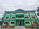
Bagong Pag Asa Health Center

Road 9
1100 Quezon City, Bago Bantay (1st District)
Philippines
mapOpen on Google Maps

228Quezon City Roads Station Landmarks 01
Share experience

Nearby Places

Mindanao Avenue
Mindanao Avenue

Mindanao Avenue (Filipino: Abenida Mindanao) is an eight-to-ten lane divided avenue connecting EDSA and NLEX and is a part of Circumferential Road 5 (C-5) in Metro Manila, Philippines. It is one of the three parallel roads that connects Tandang Sora and Congressional Avenues (Visayas Avenue and Luzon Avenue were the others); that is why it was named after the southernmost mainland of the Philippines, Mindanao. It used to be a 2-kilometer (1.2 mi) highway connecting North Avenue and Congressional Avenue, but as a part of the C-5 projects, Mindanao Avenue was extended to EDSA in the south and to Quirino Highway to the north. The new roads opened in 2000.Another road also named Mindanao Avenue, also in Quezon City, starts in Barangay Santa Monica, crosses Commonwealth Avenue and Regalado Highway, and terminates at a dead end at School of Saint Anthony in Barangay Greater Lagro, Quezon City. That road is not in any way connected to the original Mindanao Avenue but was planned to be the one and the same road according to the 1949 Master Plan for Quezon City. It would have connected the Diliman Quadrangle to the La Mesa Watershed area.Mindanao Avenue replaced some segments of Tandang Sora Avenue belonging to C-5; Tandang Sora has no access to North Luzon Expressway. NLEX Segment 8.1, also known as the NLEX Mindanao Avenue Link, began construction afterwards. In 2017, DPWH has resumed construction of the 3.2-kilometer (2.0 mi) Mindanao Avenue Extension Project, after being halted for years due to road right-of-way issues, notably involving residential areas. A total of 1.4-kilometer (0.87 mi) portion of the road was earlier completed and opened since 2014. In June 2018, DPWH has opened additional 700-meter (2,300 ft) portion from P. Dela Cruz Street to the current end at MGM Road. The road will be extended further until it meets General Luis Street in North Caloocan.