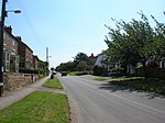
Lower Dunsforth
Borough of HarrogateFormer civil parishes in North YorkshireHarrogate geography stubsUse British English from July 2018Villages in North Yorkshire

Lower Dunsforth is a village in the civil parish of Dunsforths, in North Yorkshire, England. It was recorded in the Domesday Book (1086) as Doneforde/Dunesford/Dunesforde. St Mary's Church was rebuilt in the 1860s with a buttressed spire. Lower Dunsforth was formerly a township in the parish of Aldborough, in 1866 Lower Dunsforth became a separate civil parish, on 1 April 1960 the parish was abolished and merged with Upper Dunsforth with Branton Green to form "Dunsforths". In 1951 the parish had a population of 113. From 1974 to 2023 it was in Harrogate district.
Excerpt from the Wikipedia article Lower Dunsforth (License: CC BY-SA 3.0, Authors, Images).Lower Dunsforth
Mary Lane,
Geographical coordinates (GPS) Address Nearby Places Show on map
Geographical coordinates (GPS)
| Latitude | Longitude |
|---|---|
| N 54.076055555556 ° | E -1.3283611111111 ° |
Address
Mary Lane
Mary Lane
YO26 9SA , Dunsforths
England, United Kingdom
Open on Google Maps


