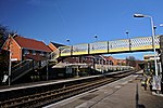
Warbreck (ward)
Use British English from March 2015Wards of Liverpool
Warbreck is a Liverpool City Council Ward in Liverpool, England. It contains the northern parts of the Walton and Orrell Park areas of Liverpool. The population of this ward taken at the 2011 census was 16,481. Its northern part also takes in the old rural district of Warbreck Moor together with the small residential area of Warbreck Park. There is also a "Warbreck" public house within the ward's boundaries situated on Orrell Lane.
Excerpt from the Wikipedia article Warbreck (ward) (License: CC BY-SA 3.0, Authors).Warbreck (ward)
Stoker Way, Liverpool Orrell Park
Geographical coordinates (GPS) Address Nearby Places Show on map
Geographical coordinates (GPS)
| Latitude | Longitude |
|---|---|
| N 53.4568 ° | E -2.9639 ° |
Address
Rice Lane
Stoker Way
L9 1GA Liverpool, Orrell Park
England, United Kingdom
Open on Google Maps


