place

Kaukajärvi

Lakes of KangasalaLakes of TampereWestern Finland Province geography stubs
Kaukajärvi from air in autumn

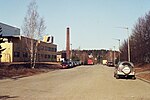
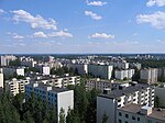
Kaukajärvi is a Finnish lake in Pirkanmaa (also known as the Tampere Region). The lake is 3.2 kilometres (2.0 mi) long, 950 metres (3,120 ft) wide and covers an area of 143 hectares (350 acres). Its average depth is 12 metres (39 ft) and the maximum depth has been measured as 23 metres (75 ft). The municipalities of Tampere and Kangasala adjoin the lake. Kaukajärvi was the venue for the 1977 World Rowing Junior Championships and the 1995 World Rowing Championships.

Excerpt from the Wikipedia article Kaukajärvi (License: CC BY-SA 3.0, Authors, Images).

Kaukajärvi
Kaarinanpolku, Tampere Kaukajärvi (Kaakkoinen suuralue)

Geographical coordinates (GPS) Address Nearby Places
placeShow on map

Wikipedia: KaukajärviContinue reading on Wikipedia

Geographical coordinates (GPS)

Latitude Longitude
N 61.470833333333 ° E 23.911111111111 °
placeShow on map

Address

Kaarinanpolku

Kaarinanpolku
33730 Tampere, Kaukajärvi (Kaakkoinen suuralue)
Finland
mapOpen on Google Maps

Kaukajärvi from air in autumn
Share experience

Nearby Places

Ristinarkku
Ristinarkku

Ristinarkku (Finnish pronunciation: [ˈristinˌɑrkːu]) is a district in Tampere, Finland. The district also includes the Janka's residential area. There are a school and several retail stores in the area. The area is close to the city center and has apartment buildings as well as townhouses. The Sampo Highway runs through Ristinarkku, and the district is bordered on the south by the Tampere–Haapamäki railway and on the east by the eastern part of the Tampere Ring Road (Highway 9). The neighboring parts of the city are Hakametsä, Huikas, Takahuhti, Pappila, Linnainmaa, Hankkio and Messukylä.The Ristinarkku area was the center of the village of Takahuhti, which belonged to Messukylä, where most of the village's houses were still built in the late 19th century as a dense group. The rest of the name Ristinarkku is most likely based on the word orko, which means a meadow or field cleared of drooping. Professor Viljo Nissilä has speculated that a surveyor who has not had local knowledge has written the word orko in what he thinks is a more understandable form of arkku (meaning "coffin"). Thus, the original name Ristinorko, which would have meant the field cleared next to the road junction and gradually also the junction, would have changed into Ristinarkku (literally meaning the "coffing of cross") with a similar phonetic status in the Finnish language. On the other hand, the word arkku is also ambiguous, as it can refer to, for example, a coffin or a bridge support. The roots of the name may date back to the 13th century, as the medieval settlement of Takahuhti had become a group village by the 14th century at the latest. The first town plan of Ristinarkku was confirmed in the 1950s.The name of the Vehnämyllynkatu street is based on the wheat mill located in Ristinarkku, built in the late 19th century. The mill was demolished in connection with the construction of a street bridge across the railway in 1957.