Germoe

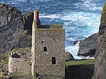
Germoe (Cornish: Germogh) is a village and civil parish in Cornwall, England, United Kingdom. Germoe village, the parish's main settlement and church town, is about five miles (8 km) west of Helston and seven miles (11.3 km) east of Penzance. The A394 Penzance to Helston road runs along the southern border of the parish. Other settlements in the parish include Balwest, Boscreege and Tresowes Green. The parish is named after Saint Germocus, one of the companions of Saint Breage. According to legend Germoc was a king in Ireland whose feast day is 6 May. Historically, the largest landowners in the parish were the Godolphin family (the Dukes of Leeds).Germoe parish is bounded to the north, east and south by Breage parish and to the west by St Hilary parish. The population was 508 in the 2001 census. This had increased to 549 at the 2011 Census. The parish is now rural in character but was once associated with mining; to the north it borders the geological formation known as the Tregonning-Godolphin Granite (one of five granite batholiths in Cornwall) and the area was formerly an important source of tin and copper ore (see Geology of Cornwall). Tregonning Hill is the site of the Germoe war memorial.
Excerpt from the Wikipedia article Germoe (License: CC BY-SA 3.0, Authors, Images).Germoe
Geographical coordinates (GPS) Address Nearby Places Show on map
Geographical coordinates (GPS)
| Latitude | Longitude |
|---|---|
| N 50.115 ° | E -5.379 ° |
Address
TR20 9QY
England, United Kingdom
Open on Google Maps


