Achterwetering
AC with 0 elementsDe BiltPopulated places in Utrecht (province)Utrecht (province) geography stubs

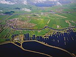
Achterwetering is a hamlet in the Dutch province of Utrecht. It is a part of the municipality of De Bilt, and lies about 4 km northwest of Bilthoven. It was first mentioned in 1696 as De Achter Weteringe, and means behind the polder canal. Achterwetering is not a statistical entity, and the postal authorities have placed it under Maartensdijk. It does not have place name signs. In 1840, it was home to 121 people. Nowadays, it consists of about 30 houses.
Excerpt from the Wikipedia article Achterwetering (License: CC BY-SA 3.0, Authors, Images).Achterwetering
Achterweteringseweg, De Bilt
Geographical coordinates (GPS) Address Nearby Places Show on map
Geographical coordinates (GPS)
| Latitude | Longitude |
|---|---|
| N 52.150277777778 ° | E 5.1519444444444 ° |
Address
Achterweteringseweg 47
3738 MB De Bilt
Utrecht, Netherlands
Open on Google Maps


