Westbroek
AC with 0 elementsDe BiltFormer municipalities of Utrecht (province)Populated places in Utrecht (province)Utrecht (province) geography stubs

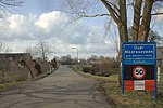
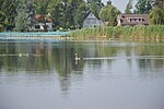
Westbroek is a village in the Dutch province of Utrecht. It is a part of the municipality of De Bilt, and lies about 6 km northwest of Bilthoven. Westbroek consists mainly of a ribbon of farms along a dike. The village is surrounded by a number of polders: the Polder Westbroek, the Kerkeindse Polder, and the Polder Achttienhoven in the north, and the Molenpolder and Polder de Kooi in the south. The Molenpolder is a nature reserve.
Excerpt from the Wikipedia article Westbroek (License: CC BY-SA 3.0, Authors, Images).Westbroek
Doctor Welfferweg, De Bilt
Geographical coordinates (GPS) Address Nearby Places Show on map
Geographical coordinates (GPS)
| Latitude | Longitude |
|---|---|
| N 52.15 ° | E 5.1333333333333 ° |
Address
Doctor Welfferweg 37
3615 AL De Bilt
Utrecht, Netherlands
Open on Google Maps


