place

Schuyler County, New York

1854 establishments in New York (state)Counties of AppalachiaNew York (state) countiesPages with non-numeric formatnum argumentsPopulated places established in 1854
Schuyler County, New YorkUse mdy dates from April 2024
Schuyler County Courthouse Watkins Glen

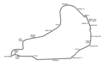
Schuyler County is a county in the U.S. state of New York. As of the 2020 census, the population was 17,898, making it the second-least populous county in New York. The county seat is the village of Watkins Glen. The name is in honor of General Philip Schuyler, one of the four major generals in the Continental Army in the American Revolutionary War. The county is part of the Southern Tier region of the state.

Excerpt from the Wikipedia article Schuyler County, New York (License: CC BY-SA 3.0, Authors, Images).

Schuyler County, New York
County Road 30,

Geographical coordinates (GPS) Address Nearby Places
placeShow on map

Wikipedia: Schuyler County, New YorkContinue reading on Wikipedia

Geographical coordinates (GPS)

Latitude Longitude
N 42.39 ° E -76.88 °
placeShow on map

Address

County Road 30

County Road 30
14891
New York, United States
mapOpen on Google Maps

Schuyler County Courthouse Watkins Glen
Share experience

Nearby Places

Watkins Glen State Park

Watkins Glen State Park is in the village of Watkins Glen, south of Seneca Lake in Schuyler County in New York's Finger Lakes region. The park's lower part is near the village, while the upper part is open woodland. It was opened to the public in 1863 and was privately run as a tourist resort until 1906, when it was purchased by New York State. Initially known as Watkins Glen State Reservation, the park was first managed by the American Scenic and Historic Preservation Society before being turned over to full state control in 1911. Since 1924, it has been managed by the Finger Lakes Region of the New York State Office of Parks, Recreation and Historic Preservation. The centerpiece of the 778-acre (3.15 km2) park is a 400-foot-deep (120 m) narrow gorge cut through rock by Glen Creek, a stream that was left hanging when glaciers of the Ice age deepened the Seneca valley, increasing the tributary stream gradient to create rapids and waterfalls wherever there were layers of hard rock. The area's rocks are sedimentary of Devonian age, part of a dissected plateau that was uplifted with little faulting or distortion. They consist mostly of soft shales, with some layers of harder sandstone and limestone. The park features three trails, open from mid-May to early November, by which one can climb or descend the gorge. The Southern Rim and Indian Trails run along the gorge's wooded rim, while the Gorge Trail is closest to the stream and runs over, under and along the park's 19 waterfalls by way of stone bridges and more than 800 stone steps. The trails connect to the Finger Lakes Trail, an 800-mile (1,300 km) system of trails within New York state.