Kobelberg
Mountains of BavariaMountains of the Bavarian ForestMountains under 1000 metresStraubing-Bogen
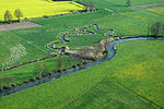
The Kobelberg is a forested mountain ridge running from north to south within the municipality of Wiesenfelden in the Bavarian Forest in southern Germany. It lies south of the village of Schiederhof between the source regions of the Großer Leitenbach to the east and the Breimbach to the west. Its three summits have heights of 692 m, 698.3 m und 703 m.According to a 2014 survey, the Kobelberg is one of 17 possible top sites for a pumped storage hydroelectric station in Bavaria. In the county of Straubing-Bogen the mountains of Pfarrerberg and Hadriwa are also in the frame.
Excerpt from the Wikipedia article Kobelberg (License: CC BY-SA 3.0, Authors).Kobelberg
Wanderweg 7,
Geographical coordinates (GPS) Address Nearby Places Show on map
Geographical coordinates (GPS)
| Latitude | Longitude |
|---|---|
| N 49.014166666667 ° | E 12.519166666667 ° |
Address
Baumwippe
Wanderweg 7
94344
Bavaria, Germany
Open on Google Maps


