place

Claybrooke Parva

Civil parishes in Harborough DistrictLeicestershire geography stubsUse British English from July 2015Villages in Leicestershire
St Peter, Claybrooke Parva geograph.org.uk 386630

Claybrooke Parva is a village and civil parish in the Harborough district south west Leicestershire, England close to Claybrooke Magna. The village is the site of a church which is thought to originally be part Anglo Saxon with Norman and Medieval additions. The population of the civil parish at the 2011 census was 208.The village's name means 'brook with clayey soil'.

Excerpt from the Wikipedia article Claybrooke Parva (License: CC BY-SA 3.0, Authors, Images).

Claybrooke Parva
Harborough Claybrooke Parva

Geographical coordinates (GPS) Address Nearby Places
placeShow on map

Wikipedia: Claybrooke ParvaContinue reading on Wikipedia

Geographical coordinates (GPS)

Latitude Longitude
N 52.483333333333 ° E -1.2666666666667 °
placeShow on map

Address


LE17 5AD Harborough, Claybrooke Parva
England, United Kingdom
mapOpen on Google Maps

St Peter, Claybrooke Parva geograph.org.uk 386630
Share experience

Nearby Places

Frolesworth
Frolesworth

Frolesworth is a small village and civil parish in the Harborough district of Leicestershire, England. It lies four miles north of Lutterworth, three from Broughton Astley and eighteen miles west of Market Harborough. The population is included in the Thurlaston civil parish. The village's name means 'enclosure of Freothulf'.A public footpath located near the side entrance of Hall Farm and from the church grounds provides wide views across surrounding countryside. The Leicestershire Round footpath crosses the parish and additional footpaths have been created around the artificial lake in the fields of Manor Farm. The majority of the parish buildings are aligned with or set back from the single main street in the village; with a small number of outlying farms, homes and businesses making up the total of eighty or so properties. The village’s boundary has changed little over two hundred years, with virtually all twentieth-century properties being infill sites along the main street. At the centre of the village is St Nicholas Church. The church commands the highest ground in the village; its tower is a local landmark when approaching the village during the day and at night when the church is lit with amber lights. From the season of 2008/09, the birth of its village's first football club, Frolesworth United was founded by the youngest chairman in the history of English football, Sam Jacques at the age of 19. Currently in a relegation battle in the Alliance Division One under the management of Rodney Jacques.

High Cross, Leicestershire

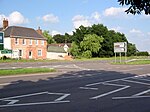
High Cross is the name given to the crossroads of the Roman roads of Watling Street and Fosse Way on the border between Leicestershire and Warwickshire, England. The parish boundaries of four villages meet at High Cross: the Warwickshire villages of Wibtoft and Copston Magna (historically part of Monks Kirby parish) and the Leicestershire parishes of Sharnford and Claybrooke Parva (historically part of the single Claybrooke parish with the closely adjacent village of Claybrooke Magna). High Cross was the site of a Romano-British settlement known as Venonae or Venonis, with a nearby fort. The remains of Venonis fort lies beneath the surface in a field to the south-east of the crossroads adjacent to the tree line and are visible from satellite images. The location of the fort was also shown on a map drawn by William Stukely in the eighteenth century when structures were more clearly visible . Excavations were carried out by Arthur Pickering in the 1930s in the region of the crossroads but not the area of the fort itself.High Cross stone monument was built in 1712. Funded by the Earl of Denbigh it celebrated the victories against France by the Duke of Blenheim as well as marking the centre of Roman Britain. It consisted of four Doric columns with an orb and cross above. It was struck by lightning in 1791 and only the plinth remains today. The stone monument was preceded by a wooden cross and was the site of a medieval gibbet. In modern times, this section of Watling Street is now a dual carriageway section of the A5, the southern part of the Fosse Way is a B road, and the northern route of the Fosse is now a track which is a part of a long-distance path called the Leicestershire Round.High Cross is depicted on the coat of arms of Blaby District Council, which is the local authority for the area. Two black diagonal lines on the shield represent Fosse Way and Watling Street.