place

Beacon Limestone Formation

Geologic formations of EnglandGeology of DorsetGeology of SomersetJurassic EnglandJurassic System of Europe
Limestone formationsPaleontology in EnglandPliensbachian StageShallow marine depositsToarcian Stage
Thorncombe Beacon from Great Ebb (geograph 5844987)

The Beacon Limestone Formation, historically known as the Junction Bed, is a formation of the early Jurassic age (Pliensbachian–Toarcian). It lies above the Dyrham Formation and below the Bridport Sand Formation. It forms part of the Lias Group. It is found within the Wessex Basin and parts of Somerset, in England. It is well known for the Strawberry Bank Lagerstätte, which contains the 3-dimensionally preserved remains of vertebrates, including marine crocodyliformes, ichthyosaurs and fish, as well as insect compression fossils.

Excerpt from the Wikipedia article Beacon Limestone Formation (License: CC BY-SA 3.0, Authors, Images).

Beacon Limestone Formation
Moorlands Road,

Geographical coordinates (GPS) Address Nearby Places
placeShow on map

Wikipedia: Beacon Limestone FormationContinue reading on Wikipedia

Geographical coordinates (GPS)

Latitude Longitude
N 50.9 ° E -2.8 °
placeShow on map

Address

Moorlands Road

Moorlands Road
TA16 5NF
England, United Kingdom
mapOpen on Google Maps

Thorncombe Beacon from Great Ebb (geograph 5844987)
Share experience

Nearby Places

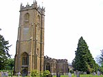
St Bartholomew's Church, Crewkerne

The Church of St Bartholomew in Crewkerne, Somerset, England dates from the 15th century and has been designated as a Grade I listed building.St Bartholomew's Parish Church stands on high ground to the west of the town. The first Saxon church was founded before the end of the 9th century as a "minster", or main church of a Saxon royal estate that included an area which later became the parishes of Seaborough, Wayford and Misterton. This church was replaced after the Norman Conquest with a larger stone cruciform building, with a central tower. This was almost completely rebuilt and enlarged in the late 15th and early 16th centuries. This is, for the most part, the church building visible today. It is an excellent example of the Perpendicular style with many unusual and individual features. These include the west front, the nave, the six-light aisle windows and the Tudor-style chapels and windows in the north east corner. The building material is golden-coloured Ham Hill stone, quarried a few miles north of Crewkerne. There is a notable pair of 'green man' carvings within the church. No major alterations have been made since the Reformation in the 1530s and 1540s, but there have been many changes to the interior to accommodate various phases of Church of England worship. Among these are an oven used for baking communion bread in the south east corner of the north chapel.During the Civil War, considerable damage was done including the destruction of nearly all of the medieval stained glass. William III of England worshipped in the church following his landing in the Glorious Revolution of 1689. By the early 19th century, all the medieval furnishings, except the Norman font had disappeared. New pews were made and the west galleries were added in 1808–11. The latest restoration that has left the church interior visible today, took place in the late 19th century; it was more sympathetic to the church's architectural character than many Victorian restorations. At this time, the central section of the west gallery was removed to reveal the great west window and the organ was relocated to the south transept. The pews date from around 1900 and have attractive carved bench-ends. Christ Church, a chapel of ease to St Bartholomew's, was built on South Street in 1852–54 to the designs of James Mountford Allen. The church was declared redundant in 1969, and demolished in 1975 to make way for the residential Christchurch Court.

Crewkerne
Crewkerne

Crewkerne ( KROO-kərn) is a town and electoral ward in south Somerset, England, 9 miles (14 km) southwest of Yeovil and 7 miles (11 km) east of Chard. The civil parish of West Crewkerne includes the hamlets of Coombe, Woolminstone and Henley, and borders the county of Dorset to the south. The town is on the main headwater of the River Parrett, A30 road and West of England Main Line railway, in modern times the slower route between the capital and the southwest peninsula, having been eclipsed by the Taunton route. The earliest written record of Crewkerne is in the 899 will of Alfred the Great who left it to his youngest son Æthelweard. After the Norman conquest it was held by William the Conqueror and in the Domesday Survey of 1086 was described as a royal manor. Crewkerne Castle was possibly a Norman motte castle. The town grew up in the late mediaeval period around the textile industry, its wealth demonstrated in the fifteenth century Church of St Bartholomew. During the 18th and 19th centuries the main industry was cloth making, including webbing, and sails for the Royal Navy. Local ecological sites include the Bincombe Beeches Local Nature Reserve and the Millwater biological Site of Special Scientific Interest. Crewkerne railway station is served by South Western Railway. There are local supermarkets and local shops, and some local industry. The town is the birthplace of several notable people and has varied cultural and sporting facilities including those at Wadham Community School.