place

Kitty Ann Mountain

Mountains of Morris County, New JerseyMountains of New JerseyRamapos
Kitty Ann Mountain
Kitty Ann Mountain

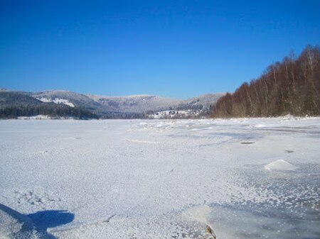
Kitty Ann Mountain in New Jersey, United States is located in the Ramapos of the Appalachian Mountains, rising above Kinnelon in Morris County. The mountain has an 80-foot tower atop it. The summit lies at 1159 feet above sea level. The prominence of the north slope is 892 feet, the highest in New Jersey; the east, west, and south slopes are 814 feet, 758 feet, and 259 feet.

Excerpt from the Wikipedia article Kitty Ann Mountain (License: CC BY-SA 3.0, Authors, Images).

Kitty Ann Mountain
Mountain Road,

Geographical coordinates (GPS) Address Nearby Places
placeShow on map

Wikipedia: Kitty Ann MountainContinue reading on Wikipedia

Geographical coordinates (GPS)

Latitude Longitude
N 41.008583333333 ° E -74.416333333333 °
placeShow on map

Address

Mountain Road

Mountain Road
07435
New Jersey, United States
mapOpen on Google Maps

Kitty Ann Mountain
Kitty Ann Mountain
Share experience

Nearby Places

Kinnelon, New Jersey

Kinnelon () is a borough in Morris County, New Jersey, United States, located approximately 33 miles (53 km) west of New York City. As of the 2010 United States Census, the borough's population was 10,248, reflecting an increase of 883 (+9.4%) from the 9,365 counted in the 2000 Census, which had in turn increased by 895 (+10.6%) from the 8,470 counted in the 1990 Census. It is a low-density, suburban community, with many parks and trails. Once known as Charlotteburg, Kinnelon was formed as a borough by an act of the New Jersey Legislature on February 20, 1922, from portions of Pequannock Township, based on the results of a referendum passed on March 21, 1922. The borough's name comes from Francis S. Kinney, who purchased 5,000 acres (20 km2) of land in the 1880s for an estate that included Lake Kinnelon, and built St. Hubert's Chapel in 1886 on an island in the lake.Kinnelon is home to Smoke Rise, an upscale private gated community that describes itself as one of the oldest gated communities in the United States. It includes more than 900 unique homes located on 2,500 acres (1,000 ha) in addition to Lake Kinnelon.In 2012, Forbes.com listed Kinnelon as 462nd in its listing of "America's Most Expensive ZIP Codes", with a median home price of $630,414.The borough is one of the state's highest-income communities. Based on data from the American Community Survey (ACS) for 2014–2018, Kinnelon residents had a median household income of $156,048, almost double the statewide median of $79,363.

Tripod Rock
Tripod Rock

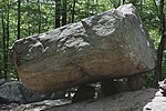
Tripod Rock is a balancing rock, or perched boulder, located in Kinnelon, New Jersey in the Pyramid Mountain Natural Historic Area. This multi-ton Precambrian gneiss boulder, located near the edge of a long ridge, is balanced on three smaller boulders. Tripod Rock is roughly 6 m (20 ft) long, 3 m (9.8 ft) wide, and 2.5 m (8 ft 2 in) high, weighing approximately 127 tonnes (280,000 lb). A triangular crest runs the length of its top. The boulder is balanced on three smaller stones roughly 1 m (3 ft 3 in) in diameter that raise it above the bedrock by about 0.5 m (1 ft 8 in) at its lowest point. The point of contact between the boulder and its support stones forms an approximate 3-4-5 triangle. About 12 m (39 ft) northwest of Tripod Rock are three other boulders comprising a triangle. The two larger boulders are partially balanced on smaller stones (see diagram). The apex rock is about 3 m (9.8 ft) to the northeast. Sighting from a bedrock outcrop near Tripod Rock through the two large boulders, the apex of the rock triangle points across to the next ridge on the western horizon. This line of sight intersects the sunset on the summer solstice. During the early 1980s, Tripod Rock and its nearby stones were surveyed. The sunset point on the ridge at the summer solstice was visible due to gypsy moth defoliation. A large boulder was visible on the ridge at the place of the summer solstice sunset. Within a year of the survey, a home was constructed on that site and the boulder was displaced by earth-moving machinery. As of 1983 the summer solstice sunset was only partially visible near the edge of that residence. Two smaller perched boulders are located northeast of Tripod Rock (not shown on diagram) measuring approximately 1–3 m (3 ft 3 in – 9 ft 10 in) in diameter. No specific calendar alignment has been noted. Tripod Rock stands on a ridge overlooking a long valley where a massive glacial erratic named Bear Rock is located near a brook. Bear Rock was thoroughly excavated for archaeological artifacts during the 19th century, some of which are reported to be owned by museums. Bear Rock has a large overhang making it a possible rock shelter. While there is no evidence that Tripod Rock was ever used as a solar observatory, it could function as one if a small portion of the ridge across the valley were kept clear. Tripod Rock is presumed to be a naturally deposited, though oddly perched, glacial erratic.

Clinton Road (New Jersey)

Clinton Road is located in West Milford, Passaic County, New Jersey. It runs in a generally north-south direction, beginning at Route 23 near Newfoundland and running roughly 10 miles (16 km) to its northern terminus at Upper Greenwood Lake. The road and the land around it have gained notoriety over the years as an area rife with many legends of paranormal occurrences such as sightings of ghosts, strange creatures, and gatherings of witches, Satanists, and the Ku Klux Klan. It is also rumored that professional killers dispose of bodies in the surrounding woods—with one recorded case of this occurring. It has been a regular subject of discussion in Weird NJ magazine, which once devoted an entire issue to it. In the words of a local police chief, "It's a long, desolate stretch and makes the imagination go nuts."There are very few houses along the road and much of the adjoining property is undeveloped publicly owned woodlands (either City of Newark watershed or state forest) and the road itself is a narrow two-lane highway that receives little maintenance, is not part of New Jersey's county route system and was until fairly recently unpaved for some of its length, connecting two areas of minimal population and growth and thus having little traffic even at the busiest times of day. It is also notorious for having the country's longest traffic light wait. This occurs at a double intersection where Route 23 crosses the road. The two lights can cause motorists to wait for 5 minutes in total. The lengthy wait was a result of traffic planners giving increased priority to Route 23 to reduce backups during rush hour.