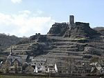
Karmelenberg

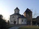
The Karmelenberg is a wooded cinder cone that was formed by volcanic activity. It marks the southeastern end of the East Eifel volcano field and rises to a height of 372 m above sea level (NHN), about 170 metres above the Pellenz region, and is visible from a long way off. In the UNO Year of Mountains (2002), the Karmelenberg was Mountain/Hill of the Month in Germany. A monument records the proclamation on 21 June 2002. As part of the Volcano Park (station 21), the hill is counted as a tourist attraction. Various information boards explain both its volcanic past as well as the history of St. Mary's Chapel at the summit. The hill is named after Mount Carmel in the Carmel massif, an important Biblical site and modern landmark in northwestern Israel. The entire cinder cone of the Karmelenberg has been designated as a nature reserve.
Excerpt from the Wikipedia article Karmelenberg (License: CC BY-SA 3.0, Authors, Images).Karmelenberg
Baumallee, Weißenthurm
Geographical coordinates (GPS) Address Nearby Places Show on map
Geographical coordinates (GPS)
| Latitude | Longitude |
|---|---|
| N 50.344166666667 ° | E 7.4233333333333 ° |
Address
NSG Karmelenberg
Baumallee
56220 Weißenthurm
Rhineland-Palatinate, Germany
Open on Google Maps
