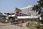
Kalikata

Kalikata was one of the three villages which were merged to form the city of Kolkata (formerly Calcutta) in India. The other two villages were Gobindapur and Sutanuti. Job Charnock, an administrator with the British East India Company is traditionally credited with the honour of founding the city. He settled in the village of Sutanuti. Kalikata was much less important than Sutanuti and Gobindapur, and this, along with the consequent abundance of space, afforded the British room to settle there. While both Sutanati and Gobindapur appear on old maps like Thomas Bowrey's of 1687 and George Herron's of 1690, Kalikata situated between the two is not depicted. However, one variant of the name, "Kalkatâ", is shown in Abu'l Fazal's Ain-i-Akbari (around 1590).
Excerpt from the Wikipedia article Kalikata (License: CC BY-SA 3.0, Authors, Images).Kalikata
Huziri Mal Lane, Kolkata Chandni Chowk East (Kolkata)
Geographical coordinates (GPS) Address Nearby Places Show on map
Geographical coordinates (GPS)
| Latitude | Longitude |
|---|---|
| N 22.566666666667 ° | E 88.366666666667 ° |
Address
Huziri Mal Lane
Huziri Mal Lane
700009 Kolkata, Chandni Chowk East (Kolkata)
West Bengal, India
Open on Google Maps


