place

Cliffe Hill Quarry

Geological Conservation Review sitesSites of Special Scientific Interest in Leicestershire
Cliffe Hill Quarry 2

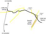
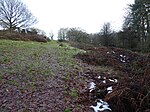
Cliffe Hill Quarry is a 19.2 hectares (47 acres) geological Site of Special Scientific Interest on the western outskirts of Markfield in Leicestershire. It is a Geological Conservation Review site.This quarry exposes volcanic and sedimentary Charnian rocks dating to the Precambrian eon. It was probably then a volcanic island. An unusually homogeneous form of the rock diorite is sometimes called markfieldite because it is found in the village.The site is private land with no public access.

Excerpt from the Wikipedia article Cliffe Hill Quarry (License: CC BY-SA 3.0, Authors, Images).

Cliffe Hill Quarry
Cliffe Hill Road, Hinckley and Bosworth Stanton-under-Bardon

Geographical coordinates (GPS) Address Nearby Places
placeShow on map

Wikipedia: Cliffe Hill QuarryContinue reading on Wikipedia

Geographical coordinates (GPS)

Latitude Longitude
N 52.691 ° E -1.3 °
placeShow on map

Address

Cliffe Hill Road

Cliffe Hill Road
LE67 9TE Hinckley and Bosworth, Stanton-under-Bardon
England, United Kingdom
mapOpen on Google Maps

Cliffe Hill Quarry 2
Share experience

Nearby Places

Thornton Reservoir
Thornton Reservoir

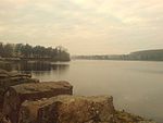
Thornton Reservoir is a small reservoir situated in the National Forest near the village of Thornton in Leicestershire. It has a surface area of 75 acres (300,000 m2) and a perimeter of 2.45 miles (3.94 km). It was originally built in 1854 when it had its own treatment works which were situated to the south of the current dam. It is now owned by Severn Trent and the water is treated a few miles away at Cropston Reservoir to which it runs via Rothley Brook. The reservoir is fed by two small streams which enter from the north via two weirs. Rothley Brook takes water away from the south. Since 1997 the reservoir and the surrounding land has been open to the public. Facilities include a small visitor centre, a sculpture trail, a woodland walk and a game fishery. Within the visitor centre is a small cafe and a bait shop which opens at 7.30am daily. Boats can be hired from 8.30am and the most common species of fish are trout. The National Cycle Network also runs around the reservoir.Planning for the reservoir began in 1847. The design included a dam where Locky Bridge had previously stood, the reservoir fed by Carr Brook and Thornton Brook. Behind the dam were two filtration tanks, and from there the water was carried via gravitation to a storage reservoir in Oadby. Supply from the reservoir began in 1853, with Thomas Cook's Temperance Hall the first building to receive water from it. The reservoir was thought sufficient to serve Leicester's population of 58,000 at the time, delivering 1.6 million gallons per day, and was the main source of water for the city until the opening of Bradgate Reservoir in 1871. The surface area was originally calculated at 55 acres with the capacity 229 million gallons. The estimated cost of building the reservoir was £80,000.The reservoir was taken out of use in 1982, but was opened up to the public in 1997, with paths around the edge and a trout fishery on the west bank.

Bardon Hill
Bardon Hill

Bardon Hill is the highest Hill in Leicestershire and on a clear day the Malvern and Shropshire Hills (approx. 50–60 miles), summits in Derbyshire (approx. 30–40 miles) and Lincoln Cathedral (almost 50 miles away) can be seen. However, the Sugar Loaf in South Wales, sometimes cited as visible from Bardon, cannot be seen, being over 90 miles (140 km) away. Near the top of the hill are two radio masts; the smaller of the two was built for the BBC as a link for Outside broadcast linking into the Sutton Coldfield Transmitter. This was then moved to the now larger mast which was originally built by an electricity supply company, it is now owned by Cellnex after Arqiva sold its UK wireless business in October 2019 and provides the NOW Leicester DAB radio service.The landscape was already attracting visitors before John Curtis wrote in the 1830s: he suggests that the view extends to over 5,000 square miles (13,000 km2) or one-twelfth of England and Wales. Potter also notes of the view from Bardon Hill that "it probably commands a greater extent of surface than any other point of view on the island" and that "An outline, described from the extremity of this view, would include nearly one-fourth of England and Wales. It may be deemed one of the most extraordinary points of view in Nature." This has attracted telecommunication companies, and large transmitters and radio masts have replaced both the Summer House and Queen Adelaide's Bower. Bardon Hill is also a 13.1-hectare (32-acre) biological Site of Special Scientific Interest (SSSI) in the civil parish of Bardon, east of Coalville in Leicestershire, England.Bardon Hill is part of the eroded remains of a volcano. It is the highest point in Leicestershire and the National Forest, 278 m (912 ft) above sea level. Due to its prominence, it is visible for many kilometres around. It adjoins Bardon Hill Quarry, a geological SSSI. At its summit are a trigonometrical point and a radio mast. The second highest hill in Leicestershire is the nearby Beacon Hill. "Bardon" or "Bardon Hill" was also the name of a village south-west of the hill. Most of the village has been demolished but the toponym "Bardon Hill" remains in use as the postal address of the remaining local properties.