Selberg (Kusel)
Kusel (district)Mountains and hills of Rhineland-Palatinate

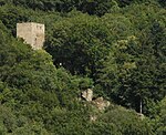
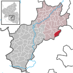
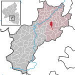
The Selberg is a hill, 545.1 m, in the county of Kusel in the German state of Rhineland-Palatinate. It is part of the North Palatine Uplands and is a southern outlier of the Königsberg. The Selberg rises between the streams of Breitenbach and Lauter. Nearby villages are Eßweiler, Rutsweiler an der Lauter and Rothselberg.
Excerpt from the Wikipedia article Selberg (Kusel) (License: CC BY-SA 3.0, Authors, Images).Selberg (Kusel)
Selbergstraße, Lauterecken-Wolfstein
Geographical coordinates (GPS) Address Nearby Places Show on map
Geographical coordinates (GPS)
| Latitude | Longitude |
|---|---|
| N 49.560833333333 ° | E 7.5952777777778 ° |
Address
Selbergstraße
67753 Lauterecken-Wolfstein
Rhineland-Palatinate, Germany
Open on Google Maps


